Approximate Location Map
Large Map »
Latitude: 53.3451 / 53°20'42"N
Longitude: -1.812 / 1°48'43"W
OS Eastings: 412611
OS Northings: 383149
OS Grid: SK126831
Mapcode National: GBR HYSR.HL
Mapcode Global: WHCCL.45DX
Plus Code: 9C5W85WQ+25
Entry Name: Milepost at Os 127 832
Listing Date: 24 September 1984
Grade: II
Source: Historic England
Source ID: 1087868
English Heritage Legacy ID: 82482
ID on this website: 101087868
Location: High Peak, Derbyshire, S33
County: Derbyshire
District: High Peak
Civil Parish: Castleton
Traditional County: Derbyshire
Lieutenancy Area (Ceremonial County): Derbyshire
Church of England Parish: Castleton St Edmund
Church of England Diocese: Derby
Tagged with: Milestone
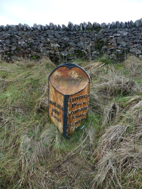
SK 18 SW PARISH OF CASTLETON BUXTON ROAD
6/21 (South Side)
Milepost at OS127832
II
Milepost. Early C19. Cast iron. Triangular in plan, the upper part cut away in
concave curve. Inscribed CHAPEL EN LE/FRITH/4 MILES. SHEFFIELD/18 MILES/
HATHERSAGE/8 MILES/CASTLETON/2 MILE (Sic)
Listing NGR: SK1261183149
External links are from the relevant listing authority and, where applicable, Wikidata. Wikidata IDs may be related buildings as well as this specific building. If you want to add or update a link, you will need to do so by editing the Wikidata entry.


Other nearby listed buildings
