Approximate Location Map
Large Map »
Latitude: 53.2558 / 53°15'20"N
Longitude: -1.7923 / 1°47'32"W
OS Eastings: 413952
OS Northings: 373214
OS Grid: SK139732
Mapcode National: GBR HZXS.RM
Mapcode Global: WHCCZ.FFRF
Plus Code: 9C5W7645+83
Entry Name: South Viaduct
Listing Date: 22 March 1985
Grade: II*
Source: Historic England
Source ID: 1087894
English Heritage Legacy ID: 82337
Also known as: Millers Dale South Viaduct
ID on this website: 101087894
Location: Millers Dale, High Peak, Derbyshire, SK17
County: Derbyshire
District: High Peak
Civil Parish: Wormhill
Traditional County: Derbyshire
Lieutenancy Area (Ceremonial County): Derbyshire
Church of England Parish: Tideswell St John the Baptist
Church of England Diocese: Derby
Tagged with: Railway viaduct
1. PARISHES OF WORMHILL AND TADDINGTON MILLERS DALE
SK17 SW South Viaduct
2/79 II*
GV
2.
This asset was subject to a minor amendment on 23/01/2015.
This asset was previously listed twice also under List entry 1334962. This entry was removed from the list on 23/01/2015.
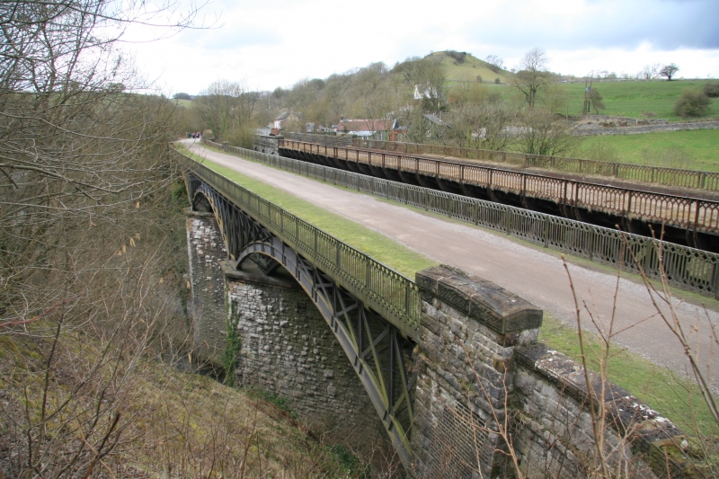
Viaduct. 1862-3, built by the Midland Railway for the main London to Manchester line.
Rock faced limestone with gritstone dressings to piers and abutments.
Wrought iron superstructure of segmental arch and spandrel construction. Three round-
arched masonry spans to west and three wrought iron spans to east, about eighty feet
from the ground. Each arch consists of five parallel ribs with lattice work strutting
filling the spandrels between the arch members and the deck above. Parapet iron railings to the deck with lattice work pattern. The viaduct crosses the dale obliquely so
that the ribs of each arch are staggered and the masonry piers are of irregular hexagon
plan.
Listing NGR: SK1395273214
External links are from the relevant listing authority and, where applicable, Wikidata. Wikidata IDs may be related buildings as well as this specific building. If you want to add or update a link, you will need to do so by editing the Wikidata entry.


Other nearby listed buildings
