Approximate Location Map
Large Map »
Latitude: 53.2576 / 53°15'27"N
Longitude: -1.3942 / 1°23'39"W
OS Eastings: 440512
OS Northings: 373568
OS Grid: SK405735
Mapcode National: GBR LZPR.YY
Mapcode Global: WHDF9.KDB0
Plus Code: 9C5W7J54+28
Entry Name: 15, High Street
Listing Date: 26 September 1977
Grade: II
Source: Historic England
Source ID: 1088277
English Heritage Legacy ID: 83362
ID on this website: 101088277
Location: Brimington, Chesterfield, Derbyshire, S43
County: Derbyshire
District: Chesterfield
Civil Parish: Brimington
Built-Up Area: Chesterfield
Traditional County: Derbyshire
Lieutenancy Area (Ceremonial County): Derbyshire
Church of England Parish: Brimington St Michael and All Angels
Church of England Diocese: Derby
Tagged with: Building
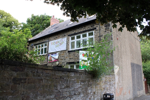
HIGH STREET
1.
5169 (West Side)
Brimington
No 15
SK 4073 10/289
II GV
2.
Early C18 altered. Coursed stone with quoins. Coped gable ends with kneelers,
slates, end red brick chimneys. 2 storeys. 2 windows, casements with painted
mullions and transom, 4 lights. Centre door in stone architrave. Windows earlier
C20.
Listing NGR: SK4051273568
External links are from the relevant listing authority and, where applicable, Wikidata. Wikidata IDs may be related buildings as well as this specific building. If you want to add or update a link, you will need to do so by editing the Wikidata entry.


Other nearby listed buildings
