Approximate Location Map
Large Map »
Latitude: 53.2578 / 53°15'27"N
Longitude: -1.3942 / 1°23'39"W
OS Eastings: 440509
OS Northings: 373587
OS Grid: SK405735
Mapcode National: GBR LZPR.YX
Mapcode Global: WHDF9.KC9W
Plus Code: 9C5W7J54+48
Entry Name: Garden Wall at Number 15
Listing Date: 26 September 1977
Grade: II
Source: Historic England
Source ID: 1088278
English Heritage Legacy ID: 83363
ID on this website: 101088278
Location: Brimington, Chesterfield, Derbyshire, S43
County: Derbyshire
District: Chesterfield
Civil Parish: Brimington
Built-Up Area: Chesterfield
Traditional County: Derbyshire
Lieutenancy Area (Ceremonial County): Derbyshire
Church of England Parish: Brimington St Michael and All Angels
Church of England Diocese: Derby
Tagged with: Wall
HIGH STREET
1.
5169 (West Side)
Brimington
-----------
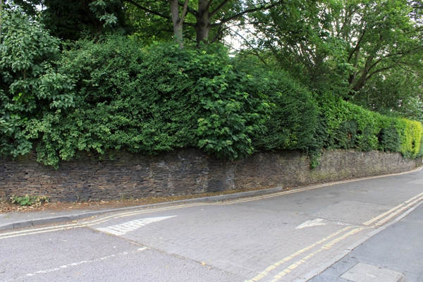
Garden wall at No 15
SK 4073 10/290
II GV
2.
Of various dates from C18 to probably early C20. Coursed stone garden wall, courses
of thin stone slabs. Coping. Height varies from circa 8 ft near house to 4 ft
(some slope in ground level).
Listing NGR: SK4050973587
External links are from the relevant listing authority and, where applicable, Wikidata. Wikidata IDs may be related buildings as well as this specific building. If you want to add or update a link, you will need to do so by editing the Wikidata entry.


Other nearby listed buildings
