Approximate Location Map
Large Map »
Latitude: 51.8863 / 51°53'10"N
Longitude: -1.7585 / 1°45'30"W
OS Eastings: 416716
OS Northings: 220891
OS Grid: SP167208
Mapcode National: GBR 4QF.L77
Mapcode Global: VHB1W.GVP9
Plus Code: 9C3WV6PR+GH
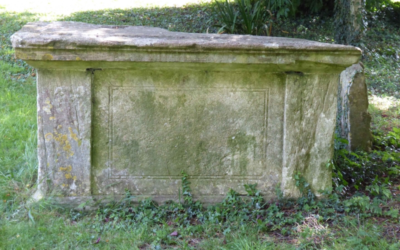
Entry Name: C18 Table Tomb to North of Church
Listing Date: 12 August 1983
Grade: II
Source: Historic England
Source ID: 1088768
English Heritage Legacy ID: 126450
ID on this website: 101088768
Location: St Lawrence's Church, Bourton-on-the-Water, Cotswold, Gloucestershire, GL54
County: Gloucestershire
District: Cotswold
Civil Parish: Bourton-on-the-Water
Built-Up Area: Bourton-on-the-Water
Traditional County: Gloucestershire
Lieutenancy Area (Ceremonial County): Gloucestershire
Church of England Parish: Bourton-on-the-Water with Clapton St Lawrence
Church of England Diocese: Gloucester
Tagged with: Tomb
5224 HIGH STREET
1. (north-east side)
C18 Table Tomb to north
of Church
SP 1620 NE 3/65
II GV
2.
C18. Plain stone table tomb with incised panel sides.
Listing NGR: SP1671620891
External links are from the relevant listing authority and, where applicable, Wikidata. Wikidata IDs may be related buildings as well as this specific building. If you want to add or update a link, you will need to do so by editing the Wikidata entry.


Other nearby listed buildings
