Approximate Location Map
Large Map »
Latitude: 51.387 / 51°23'13"N
Longitude: 1.384 / 1°23'2"E
OS Eastings: 635544
OS Northings: 170766
OS Grid: TR355707
Mapcode National: GBR WZS.W6B
Mapcode Global: VHLG6.YD0K
Plus Code: 9F3399PM+RH
Entry Name: 13, Hawley Square
Listing Date: 22 February 1973
Grade: II
Source: Historic England
Source ID: 1088969
English Heritage Legacy ID: 356554
ID on this website: 101088969
Location: Margate, Thanet, Kent, CT9
County: Kent
District: Thanet
Electoral Ward/Division: Margate Central
Parish: Non Civil Parish
Built-Up Area: Margate
Traditional County: Kent
Lieutenancy Area (Ceremonial County): Kent
Tagged with: Building
HAWLEY SQUARE
1.
1380
(North Side)
No 13
TR 3570 NE 6/40
II GV
2.
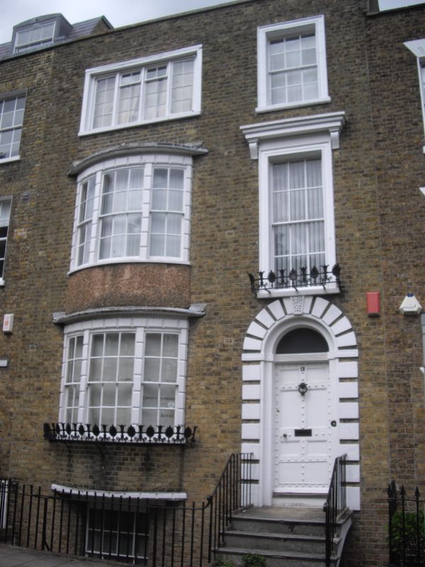
Early C19, 3 storeys and basement brown brick. Slate roof. 1 sash set in
Italianate architrave and 3 light bays on lower floors. Simple round-headed
doorcase with rusticated surround and panelled door. Area railings.
Nos 4 to 6 (consec), former Holy Trinity Hall, former Methodist Chapel
and Nos 12 to 16A (consec) form a group
Listing NGR: TR3554470766
External links are from the relevant listing authority and, where applicable, Wikidata. Wikidata IDs may be related buildings as well as this specific building. If you want to add or update a link, you will need to do so by editing the Wikidata entry.


Other nearby listed buildings
