Approximate Location Map
Large Map »
Latitude: 51.4435 / 51°26'36"N
Longitude: 0.3751 / 0°22'30"E
OS Eastings: 565158
OS Northings: 174282
OS Grid: TQ651742
Mapcode National: GBR NMK.KN2
Mapcode Global: VHJLC.GZ5B
Plus Code: 9F32C9VG+93
Entry Name: 47, the Terrace
Listing Date: 3 July 1975
Grade: II
Source: Historic England
Source ID: 1089006
English Heritage Legacy ID: 356442
ID on this website: 101089006
Location: Milton, Gravesham, Kent, DA12
County: Kent
District: Gravesham
Electoral Ward/Division: Riverside
Parish: Non Civil Parish
Built-Up Area: Gravesend
Traditional County: Kent
Lieutenancy Area (Ceremonial County): Kent
Church of England Parish: Gravesend St George
Church of England Diocese: Rochester
Tagged with: Building
TQ 6574 SW 2/205
5277
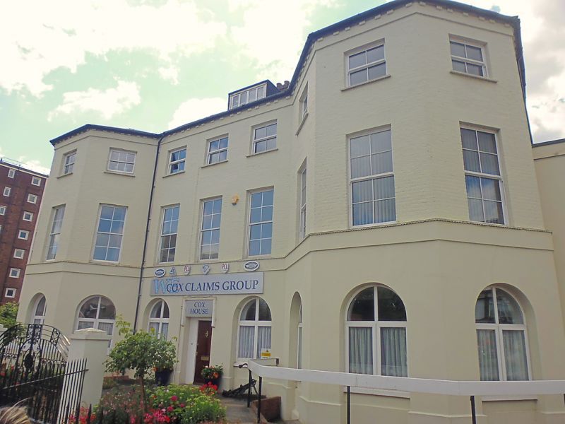
THE TERRACE
No. 47
(Formerly listed as Uralite House, WHITEHALL PLACE)
II
A mid C19 house. 3 storeys and attics painted brick. Slate roof. 9 windows
in all, including 2 3-light bays on either side through all storeys. The ground
floor has restored round-headed windows and an altered doorcase with hoodmoulding.
Listing NGR: TQ6515874282
External links are from the relevant listing authority and, where applicable, Wikidata. Wikidata IDs may be related buildings as well as this specific building. If you want to add or update a link, you will need to do so by editing the Wikidata entry.


Other nearby listed buildings
