Approximate Location Map
Large Map »
Latitude: 51.3331 / 51°19'59"N
Longitude: -1.2415 / 1°14'29"W
OS Eastings: 452938
OS Northings: 159608
OS Grid: SU529596
Mapcode National: GBR 945.BYG
Mapcode Global: VHCZS.FRJD
Plus Code: 9C3W8QM5+69
Entry Name: Barn Immediately North of Nutkins Farmhouse
Listing Date: 18 May 1984
Grade: II
Source: Historic England
Source ID: 1092463
English Heritage Legacy ID: 138262
ID on this website: 101092463
Location: Kingsclere, Basingstoke and Deane, Hampshire, RG20
County: Hampshire
District: Basingstoke and Deane
Civil Parish: Kingsclere
Traditional County: Hampshire
Lieutenancy Area (Ceremonial County): Hampshire
Church of England Parish: Kingsclere
Church of England Diocese: Winchester
Tagged with: Barn
SU 55 NW KINGSCLERE UNION LANE
8/23
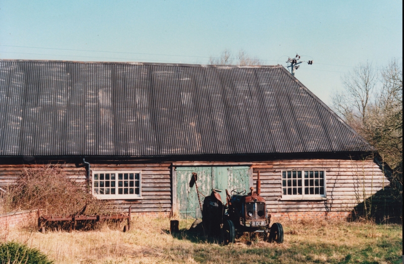
Barn immedately north
of Nutkins Farmhouse
II
C18. Four-bay timber-frame with aisles on one long and one short side. Queen post
truss. Corrugated-iron roof. Boarded walls.
Listing NGR: SU5283757840
External links are from the relevant listing authority and, where applicable, Wikidata. Wikidata IDs may be related buildings as well as this specific building. If you want to add or update a link, you will need to do so by editing the Wikidata entry.


Other nearby listed buildings
