Approximate Location Map
Large Map »
Latitude: 51.1018 / 51°6'6"N
Longitude: -0.8254 / 0°49'31"W
OS Eastings: 482334
OS Northings: 134266
OS Grid: SU823342
Mapcode National: GBR DCF.VGM
Mapcode Global: VHDYM.MKZQ
Plus Code: 9C3X452F+PR
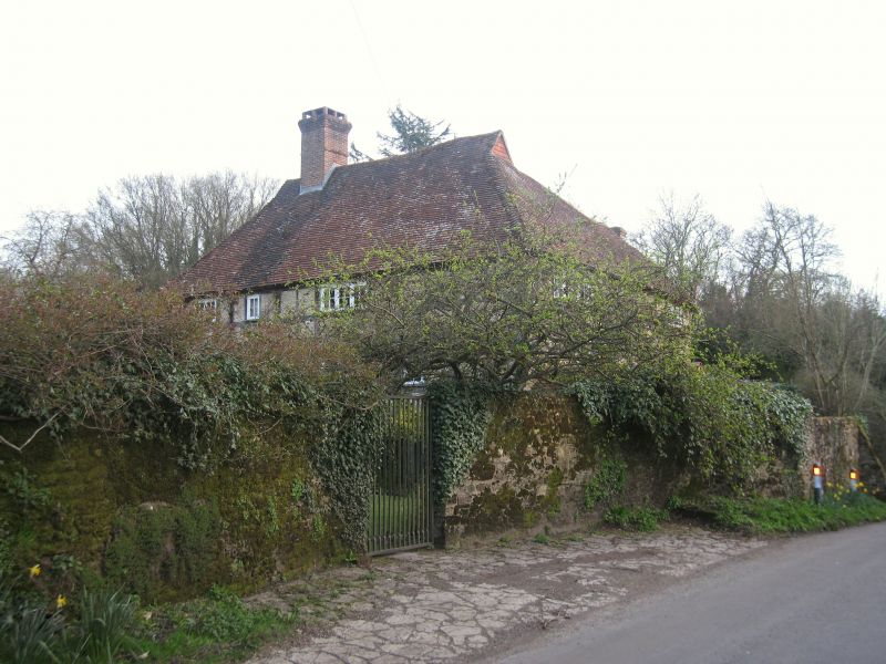
Entry Name: Passfield Farmhouse
Listing Date: 23 January 1986
Grade: II
Source: Historic England
Source ID: 1094488
English Heritage Legacy ID: 143111
ID on this website: 101094488
Location: Passfield, East Hampshire, GU30
County: Hampshire
District: East Hampshire
Civil Parish: Bramshott and Liphook
Traditional County: Hampshire
Lieutenancy Area (Ceremonial County): Hampshire
Church of England Parish: Bramshott and Liphook St Mary the Virgin
Church of England Diocese: Portsmouth
Tagged with: Farmhouse
BRAMSHOTT & LIPHOOK PASSFIELD ROAD
SU 83 SW
6/6 Passfield Farmhouse
23/01/86 II
House. C16, restored C20. Timber-framed walls with ironstone infill. Steep tile
roof, with hips and half-hip, and gablets. L-shaped building of two storeys,
irregular fenestration. c20 casements. C20 boarded door.
External links are from the relevant listing authority and, where applicable, Wikidata. Wikidata IDs may be related buildings as well as this specific building. If you want to add or update a link, you will need to do so by editing the Wikidata entry.


Other nearby listed buildings
