Approximate Location Map
Large Map »
Latitude: 51.0685 / 51°4'6"N
Longitude: -1.314 / 1°18'50"W
OS Eastings: 448160
OS Northings: 130131
OS Grid: SU481301
Mapcode National: GBR 85V.YC7
Mapcode Global: FRA 8649.7X6
Plus Code: 9C3W3M9P+C9
Entry Name: Hyde Abbey Gateway
Listing Date: 24 March 1950
Grade: I
Source: Historic England
Source ID: 1095419
English Heritage Legacy ID: 144672
ID on this website: 101095419
Location: Hyde, Winchester, Hampshire, SO23
County: Hampshire
District: Winchester
Electoral Ward/Division: St Bartholomew
Parish: Non Civil Parish
Built-Up Area: Winchester
Traditional County: Hampshire
Lieutenancy Area (Ceremonial County): Hampshire
Church of England Parish: Winchester, Hyde St Bartholomew
Church of England Diocese: Winchester
Tagged with: Gate
KING ALFRED PLACE
1.
1833
(South Side)
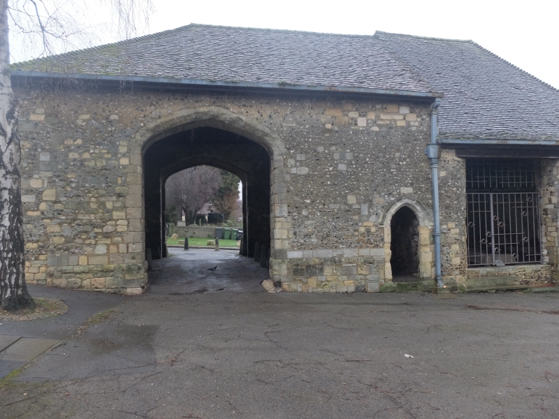
Hyde Abbey Gateway
SU 4830 SW 1/152 24.3.50.
I GV
2.
C15. Flint with stone dressings and tiled roof. Large four-centred carriage
arch and smaller one for foot passengers. Open braced queen post roof.
AM.
All the listed buildings in King Alfred Place form a group.
Listing NGR: SU4751629417
External links are from the relevant listing authority and, where applicable, Wikidata. Wikidata IDs may be related buildings as well as this specific building. If you want to add or update a link, you will need to do so by editing the Wikidata entry.


Other nearby listed buildings
