Approximate Location Map
Large Map »
Latitude: 52.2004 / 52°12'1"N
Longitude: -2.1697 / 2°10'11"W
OS Eastings: 388495
OS Northings: 255815
OS Grid: SO884558
Mapcode National: GBR 1G6.47R
Mapcode Global: VH92N.BYSJ
Plus Code: 9C4V6R2J+54
Entry Name: Granary About 100 Metres South-West of Trotshill Farmhouse
Listing Date: 26 November 1986
Grade: II
Source: Historic England
Source ID: 1095988
English Heritage Legacy ID: 147304
ID on this website: 101095988
Location: Warndon, Worcester, Worcestershire, WR4
County: Worcestershire
District: Worcester
Civil Parish: Warndon
Built-Up Area: Worcester
Traditional County: Worcestershire
Lieutenancy Area (Ceremonial County): Worcestershire
Church of England Parish: Warndon St Nicholas
Church of England Diocese: Worcester
Tagged with: Granary
WARNDON TROTSHILL
SO 85 NE
22/4 Granary about 100 metres
south-west of Trotshill
Farmhouse
- II
SO 85 NE WARNDON TROTSHILL
2/612 Granary about 100 metres
south-west of Trotshill
Farmhouse
- II
------------------------------------
WARNDON CP TROTSHILL
SO 85 NE
22/4
Granary about 100 metres
south-west of Trotshill
Farmhouse
- II
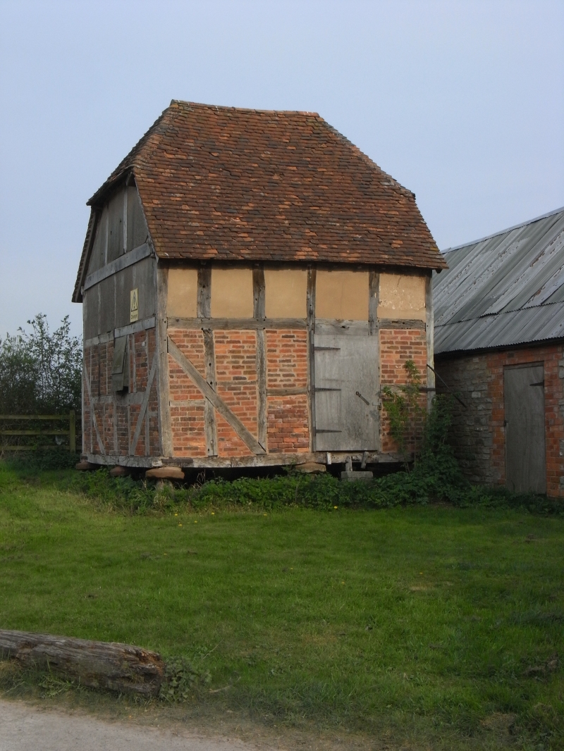
Granary. Late Cl7. Timber-frame with some brick and some wattle-and-daub
infill, on staddle stones, half hipped tile roof. Square plan. Entrance
in west wall, Cl7 door with decorative strap hinges and circular cat door;
small window in north wall. Framing: three rectangular panels high with
straight tension braces. Interior: floor joist ovolo moulded with date
inscription, beam probably reused: "[B B] OAB ANO 1660" (first two letters
could be R or B).
Listing NGR: SO8849555815
External links are from the relevant listing authority and, where applicable, Wikidata. Wikidata IDs may be related buildings as well as this specific building. If you want to add or update a link, you will need to do so by editing the Wikidata entry.


Other nearby listed buildings
