Approximate Location Map
Large Map »
Latitude: 54.7145 / 54°42'52"N
Longitude: -3.5021 / 3°30'7"W
OS Eastings: 303328
OS Northings: 536539
OS Grid: NY033365
Mapcode National: GBR 3FZX.LR
Mapcode Global: WH5YB.5RLM
Plus Code: 9C6RPF7X+R4
Entry Name: 1, New Crown Yard
Listing Date: 22 April 2003
Grade: II
Source: Historic England
Source ID: 1096126
English Heritage Legacy ID: 490092
ID on this website: 101096126
Location: Maryport, Cumberland, Cumbria, CA15
County: Cumbria
District: Allerdale
Civil Parish: Maryport
Built-Up Area: Maryport
Traditional County: Cumberland
Lieutenancy Area (Ceremonial County): Cumbria
Church of England Parish: Maryport St Mary with Christ Church
Church of England Diocese: Carlisle
Tagged with: Building
MARYPORT
887/0/10007 NEW CROWN YARD
22-APR-03 South Quay
1
II
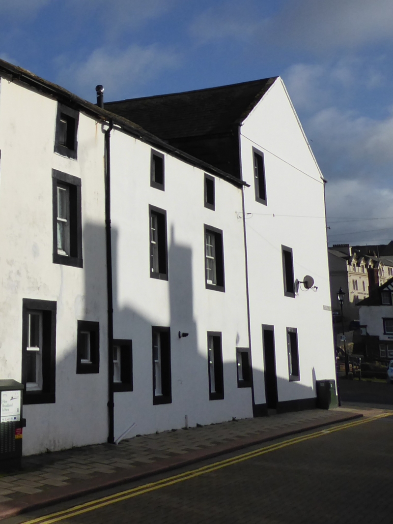
House. Formerly two dwellings, late 18th century with later alterations, adjoining 2 South Quay at right angles and entered from New Crown Yard. 2 and 3 South Quay were built in 1785 and this structure was erected shortly afterwards.
Bridge Street elevation has no doors. Rendered cobble and rubble sandstone walls. Cumbrian blue slate roof laid to diminishing courses. 3 storeys, 4 bays. Elevation is symmetrical with the central bays having 12-paned sashes to ground floor and similar on the first floor (although the right hand window has been enlarged). Second floor has small mock sashes under eaves. Each outer bay has a 6-pane (3 over 3) sash to the ground floor. The majority of the sashes of original appearance without lack horns.
Yard elevation has 20th century rooflights. On the ground floor there is a 6-panelled door to the right and to the left are two 12-paned, vertically sliding, sashes of different sizes and a small 4-paned sash. The first floor also has two 12-paned sashes of different sizes and the second floor has 2 small mock sashes under the eaves. A further 12-paned sash window on the extreme left sits between the ground and first floor. Yard elevation retains original (working) gas lamp attached to wall. Has group value with the Naval Club, Nos. 15 and 16 Bridge Street and the properties on South Quay.
Sources
J.D. Marshall and M. Davies-Shiel Industrial Archaeology of the Lake Counties, 1977.
E. Hughes North Country Life in the Eighteenth Century, Vol II, Cumberland and Westmorland 1700-1830, 1965.
External links are from the relevant listing authority and, where applicable, Wikidata. Wikidata IDs may be related buildings as well as this specific building. If you want to add or update a link, you will need to do so by editing the Wikidata entry.


Other nearby listed buildings
