Approximate Location Map
Large Map »
Latitude: 51.3634 / 51°21'48"N
Longitude: 0.357 / 0°21'25"E
OS Eastings: 564188
OS Northings: 165341
OS Grid: TQ641653
Mapcode National: GBR NNJ.F3Q
Mapcode Global: VHJLR.4ZMP
Plus Code: 9F329974+9R
Entry Name: Barnside
Listing Date: 26 July 1983
Grade: II
Source: Historic England
Source ID: 1096356
English Heritage Legacy ID: 356828
ID on this website: 101096356
Location: Meopham Green, Gravesham, Kent, DA13
County: Kent
District: Gravesham
Civil Parish: Meopham
Built-Up Area: Meopham
Traditional County: Kent
Lieutenancy Area (Ceremonial County): Kent
Church of England Parish: Meopham St John the Baptist
Church of England Diocese: Rochester
Tagged with: Building
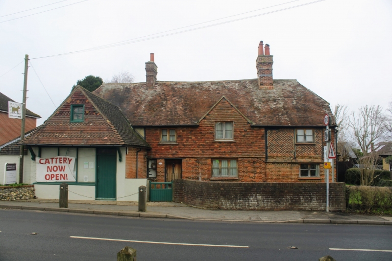
TQ 66 NW MEOPHAM WROTHAM ROAD
4/99 (west side)
Barnside
II
C17 or earlier. Timber-framed faced later in brick on ground floor with part brick
nogging on first floor and remainder tile-hung. Tiled roof. L-shaped plan. Small
gable centre front. Modern metal windows. Modern brick and tile single-storey
butchers shop projects forward at south end. South gable end is faced in sandtex type
finish.
Listing NGR: TQ6418865341
External links are from the relevant listing authority and, where applicable, Wikidata. Wikidata IDs may be related buildings as well as this specific building. If you want to add or update a link, you will need to do so by editing the Wikidata entry.


Other nearby listed buildings
