Approximate Location Map
Large Map »
Latitude: 51.2772 / 51°16'38"N
Longitude: 1.0862 / 1°5'10"E
OS Eastings: 615346
OS Northings: 157645
OS Grid: TR153576
Mapcode National: GBR TY2.ZBT
Mapcode Global: VHLGM.S536
Plus Code: 9F3373GP+VF
Entry Name: 17 and 18, Love Lane
Listing Date: 7 September 1973
Grade: II
Source: Historic England
Source ID: 1096990
English Heritage Legacy ID: 439702
ID on this website: 101096990
Location: Canterbury, Kent, CT1
County: Kent
District: Canterbury
Electoral Ward/Division: Barton
Parish: Non Civil Parish
Built-Up Area: Canterbury
Traditional County: Kent
Lieutenancy Area (Ceremonial County): Kent
Tagged with: Building
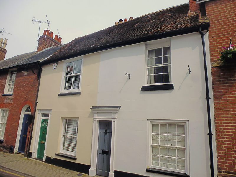
1.
944 LOVE LANE
(East Side)
Nos 17 & 18
TR 1557 NW 5/558
II GV
2.
Early C19 pair. 2 storeys stuccoed. 1 sash each with verticals only. Simple
doorcases. No 17 has a rectangular fanlight and pilasters.
Nos 14 to 18 (consec) form a group, together with No 6A Longport.
Listing NGR: TR1535257646
External links are from the relevant listing authority and, where applicable, Wikidata. Wikidata IDs may be related buildings as well as this specific building. If you want to add or update a link, you will need to do so by editing the Wikidata entry.


Other nearby listed buildings
