Approximate Location Map
Large Map »
Latitude: 50.5474 / 50°32'50"N
Longitude: -4.1471 / 4°8'49"W
OS Eastings: 247978
OS Northings: 74157
OS Grid: SX479741
Mapcode National: GBR NW.GW1V
Mapcode Global: FRA 276M.85N
Plus Code: 9C2QGVW3+W5
Entry Name: Council Depot
Listing Date: 20 December 1983
Grade: II
Source: Historic England
Source ID: 1105840
English Heritage Legacy ID: 93418
Also known as: The Wharf, Tavistock
Wharf Centre
ID on this website: 101105840
Location: Tavistock, West Devon, PL19
County: Devon
District: West Devon
Civil Parish: Tavistock
Built-Up Area: Tavistock
Traditional County: Devon
Lieutenancy Area (Ceremonial County): Devon
Tagged with: Theatre Arts centre
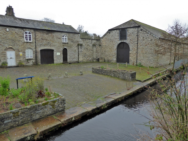
1.
5185 CANAL ROAD
(south west side)
Council Depot
SX 4774 3/37
II GV
2.
Circa 1817. One of the only 2 remaining warehouses of Canal Wharf where the copper
from Tavistock was transported to Morwellham Quay. One storey stone rubble. Half-
hipped tarred slate roof. One round-headed window and round-headed arch.
Listing NGR: SX4797874157
External links are from the relevant listing authority and, where applicable, Wikidata. Wikidata IDs may be related buildings as well as this specific building. If you want to add or update a link, you will need to do so by editing the Wikidata entry.


Other nearby listed buildings
