Approximate Location Map
Large Map »
Latitude: 51.1542 / 51°9'15"N
Longitude: 0.7077 / 0°42'27"E
OS Eastings: 589455
OS Northings: 142928
OS Grid: TQ894429
Mapcode National: GBR QV4.KQY
Mapcode Global: VHKKK.7800
Plus Code: 9F325P35+M3
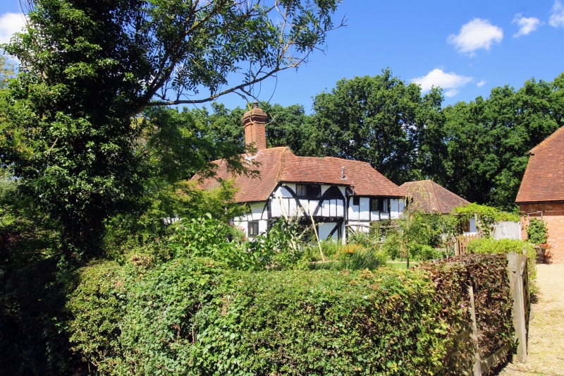
Entry Name: Tolhurst Farmhouse
Listing Date: 10 October 1980
Grade: II
Source: Historic England
Source ID: 1107930
English Heritage Legacy ID: 181224
ID on this website: 101107930
Location: Biddenden Green, Ashford, Kent, TN27
County: Kent
District: Ashford
Civil Parish: Smarden
Traditional County: Kent
Lieutenancy Area (Ceremonial County): Kent
Tagged with: Farmhouse
1.
5272 SMARDEN PLUCKLEY ROAD
Tolhurst Farmhouse
TQ 8942 29/41
II
2.
A timber-framed building, probably a late mediaeval hall-house refaced with
weatherboarding, the first floor of the west front oversailing on brackets.
Hipped tiled roof with alternate diagonal stripes of red and brown tiles. Massive
C17 brick chimney stack, smoke louvres and one hipped dormer. Two casement
windows.
Listing NGR: TQ8945542928
External links are from the relevant listing authority and, where applicable, Wikidata. Wikidata IDs may be related buildings as well as this specific building. If you want to add or update a link, you will need to do so by editing the Wikidata entry.


Other nearby listed buildings
