Approximate Location Map
Large Map »
Latitude: 51.0063 / 51°0'22"N
Longitude: -2.1956 / 2°11'44"W
OS Eastings: 386371
OS Northings: 123004
OS Grid: ST863230
Mapcode National: GBR 1XH.XBP
Mapcode Global: FRA 669G.6F9
Plus Code: 9C3V2R43+GQ
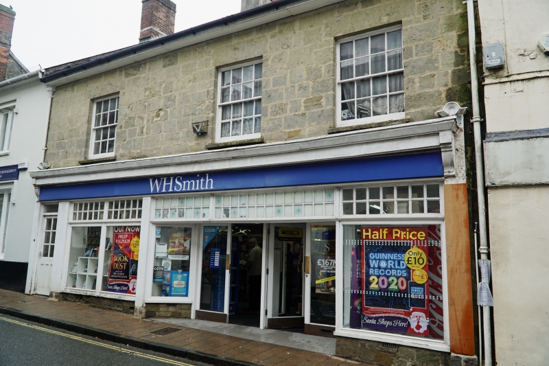
Entry Name: 42, High Street
Listing Date: 15 October 1973
Grade: II
Source: Historic England
Source ID: 1108750
English Heritage Legacy ID: 102060
ID on this website: 101108750
Location: Shaftesbury, Dorset, SP7
County: Dorset
Civil Parish: Shaftesbury
Built-Up Area: Shaftesbury
Traditional County: Dorset
Lieutenancy Area (Ceremonial County): Dorset
Church of England Parish: Shaftesbury St Peter
Church of England Diocese: Salisbury
Tagged with: Building
1.
1615 HIGH STREET
(North Side)
No 42
ST 8623 1/182
II GV
2.
Building with C19 front. 2 storeys, 3 windows. Slate gabled roof; central
stack. Ashlar front. Windows 3 Panes wide in reveals. Modern shop front.
Nos 38 to 44 (even) form a group.
Listing NGR: ST8636423018
External links are from the relevant listing authority and, where applicable, Wikidata. Wikidata IDs may be related buildings as well as this specific building. If you want to add or update a link, you will need to do so by editing the Wikidata entry.


Other nearby listed buildings
