Approximate Location Map
Large Map »
Latitude: 53.2842 / 53°17'3"N
Longitude: -1.2068 / 1°12'24"W
OS Eastings: 452978
OS Northings: 376654
OS Grid: SK529766
Mapcode National: GBR NZ0G.JD
Mapcode Global: WHDF6.FQK3
Plus Code: 9C5W7QMV+M7
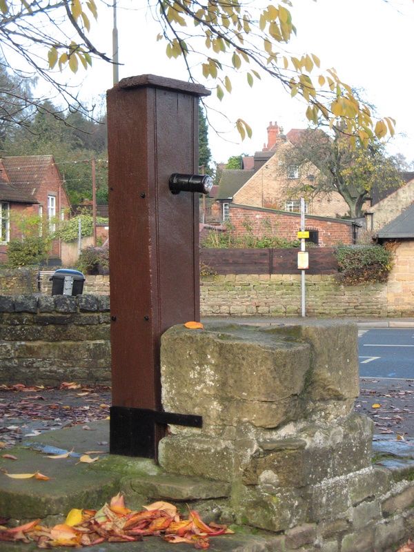
Entry Name: Village Pump
Listing Date: 23 March 1989
Grade: II
Source: Historic England
Source ID: 1108940
English Heritage Legacy ID: 79342
ID on this website: 101108940
Location: Whitwell, Bolsover, Derbyshire, S80
County: Derbyshire
District: Bolsover
Civil Parish: Whitwell
Built-Up Area: Whitwell
Traditional County: Derbyshire
Lieutenancy Area (Ceremonial County): Derbyshire
Church of England Parish: Whitwell St Lawrence
Church of England Diocese: Derby
Tagged with: Well
SK 57 NW PARISH OF WHITWELL THE SQUARE
2/173 (South Side)
Village Pump
II
Pump. C19. Sandstone base, timber and cast iron pump. The base has shallow steps
up on two sides and a square plinth to support the water receptical. Pump enclosed
in a timber box with overhanging top.
Listing NGR: SK5297876654
External links are from the relevant listing authority and, where applicable, Wikidata. Wikidata IDs may be related buildings as well as this specific building. If you want to add or update a link, you will need to do so by editing the Wikidata entry.


Other nearby listed buildings
