Approximate Location Map
Large Map »
Latitude: 50.7148 / 50°42'53"N
Longitude: -2.436 / 2°26'9"W
OS Eastings: 369312
OS Northings: 90667
OS Grid: SY693906
Mapcode National: GBR PY.RG78
Mapcode Global: FRA 57S6.2SL
Plus Code: 9C2VPH77+WH
Entry Name: Warehouse Opposite No 20
Listing Date: 8 May 1975
Grade: II
Source: Historic England
Source ID: 1110592
English Heritage Legacy ID: 104247
ID on this website: 101110592
Location: Dorchester, Dorset, DT1
County: Dorset
Civil Parish: Dorchester
Built-Up Area: Dorchester
Traditional County: Dorset
Lieutenancy Area (Ceremonial County): Dorset
Church of England Parish: Dorchester and West Stafford
Church of England Diocese: Salisbury
Tagged with: Warehouse
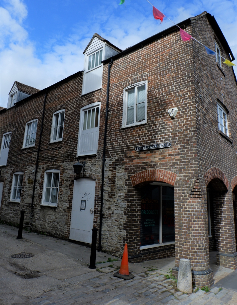
SY 6990 7/163
5191
DURNGATE STREET (North Side),
Warehouse opposite No 20
(Formerly listed under DUMGATE STREET)
II
Early C19. Portland rubble ground floor. Brown brick 1st floor. Half-hipped
tile roof. 2 storeys and lofts. West elevation has various segment-headed
Yorkshire casements, and 2 ranges of planked loading doors, those to loft with
pitched dormer over.
Listing NGR: SY6931290667
External links are from the relevant listing authority and, where applicable, Wikidata. Wikidata IDs may be related buildings as well as this specific building. If you want to add or update a link, you will need to do so by editing the Wikidata entry.


Other nearby listed buildings
