Approximate Location Map
Large Map »
Latitude: 51.444 / 51°26'38"N
Longitude: -0.9623 / 0°57'44"W
OS Eastings: 472212
OS Northings: 172175
OS Grid: SU722721
Mapcode National: GBR QNK.XT
Mapcode Global: VHDWT.8YLY
Plus Code: 9C3XC2VQ+H3
Entry Name: Christ Church
Listing Date: 14 December 1978
Grade: II*
Source: Historic England
Source ID: 1113441
English Heritage Legacy ID: 38852
ID on this website: 101113441
Location: Christ Church, The Mount, Reading, Berkshire, RG2
County: Reading
Electoral Ward/Division: Redlands
Parish: Non Civil Parish
Built-Up Area: Reading
Traditional County: Berkshire
Lieutenancy Area (Ceremonial County): Berkshire
Church of England Parish: Reading Christ Church
Church of England Diocese: Oxford
Tagged with: Church building
SU 7272
9/440
Christchurch Road (south side)
Christ Church
II*
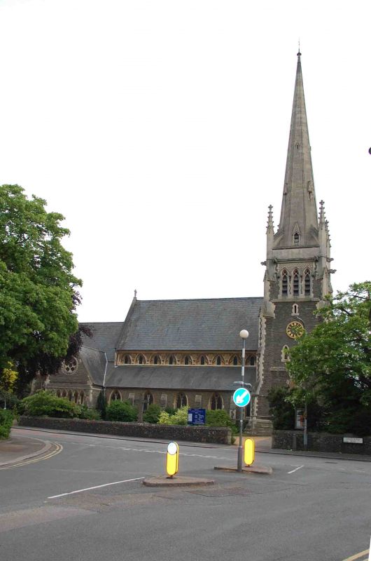
Church of England 1861-2 by Henry Woodyer. Enlarged 1874. An extremely good and large High Victorian Church and one of Reading's landmarks. Early English style. North-west tower porch capped by steeple. Built in coursed Pennant sandstone rubble with ashlar quoins and dressings. Tiled roofs. Six bay aisled nave and lower three bay chancel. Latter has later vestry (as north transept externally with arcaded string, pointed doorway and plate tracery occulus).
1874 south chapel. Nave clerestory consists of small foiled lancets set in a bold ashlar blind traceried arcade. Aisle windows also cusped, divided by buttresses. Geometric tracery window to chancel and five light decorated-style east window.
Tower and steeple are the main features, completed 1875 (though carving unfinished). Three stage tower with angle buttresses with stepped plinth and various set offs, capped by diagonal pinnacles taking fliers to steeple. Gargoyles and unfinished decoration to parapet. Total height to top of steeple 164 ft. Uncarved crockets to south porch.
Interior: ruin feature is the chancel arch whose upper part is filled with reticulated tracery (said to represent the Veil of the Temple). Arcade has Purbeck shafts and gablets to capitals which have large naturalistic flowers. cusped rere-arches to clerestory. Queen post roof with wind braces. Collar purlin roof with scissor braces in chancel. Pulpit, also probably by Woodyer, in two stages. Low flint wall about four ft high and with chamfered capping to street. The church was originally planned as a 'chapel of ease' for St Giles', to cope with an expanding parish. Woodyer's school in Basingstoke Road (qv St Paul's School) was used until Christ Church was ready.
Listing NGR: SU7221272175
External links are from the relevant listing authority and, where applicable, Wikidata. Wikidata IDs may be related buildings as well as this specific building. If you want to add or update a link, you will need to do so by editing the Wikidata entry.


Other nearby listed buildings
