Approximate Location Map
Large Map »
Latitude: 51.4556 / 51°27'20"N
Longitude: -0.9825 / 0°58'57"W
OS Eastings: 470791
OS Northings: 173449
OS Grid: SU707734
Mapcode National: GBR QJF.DN
Mapcode Global: VHDWS.XPF0
Plus Code: 9C3XF248+6X
Entry Name: 118, Oxford Road
Listing Date: 14 December 1978
Grade: II
Source: Historic England
Source ID: 1113551
English Heritage Legacy ID: 39109
ID on this website: 101113551
Location: Reading, Berkshire, RG1
County: Reading
Electoral Ward/Division: Abbey
Parish: Non Civil Parish
Built-Up Area: Reading
Traditional County: Berkshire
Lieutenancy Area (Ceremonial County): Berkshire
Church of England Parish: Reading Holy Trinity
Church of England Diocese: Oxford
Tagged with: Building
1.
5128
SU 7073
12/541
OXFORD ROAD
(North Side)
No 118
II
2.
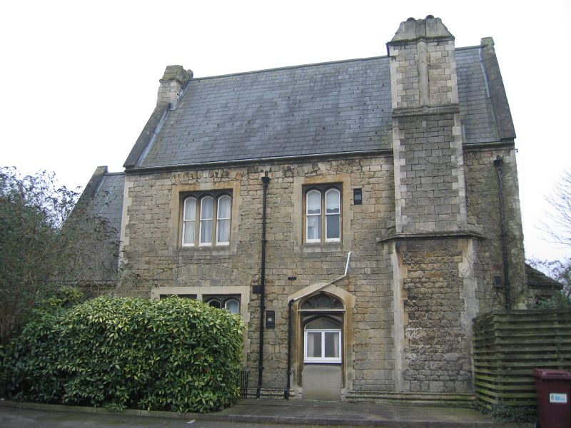
Circa 1845, probably by John Billing. Ashlar 2 1/2 storey villa with slate roof
and extruded chimneys. 2 storey angled bays flanking present (modern) entrance
and with gables above having 2 light windows to attic. Gabled porch to west.
Listing NGR: SU7079173449
External links are from the relevant listing authority and, where applicable, Wikidata. Wikidata IDs may be related buildings as well as this specific building. If you want to add or update a link, you will need to do so by editing the Wikidata entry.


Other nearby listed buildings
