Approximate Location Map
Large Map »
Latitude: 52.0574 / 52°3'26"N
Longitude: -0.2714 / 0°16'17"W
OS Eastings: 518613
OS Northings: 241305
OS Grid: TL186413
Mapcode National: GBR H4J.XX7
Mapcode Global: VHGN6.7KW3
Plus Code: 9C4X3P4H+XC
Entry Name: Church Farm Cottage Church Farmhouse
Listing Date: 2 January 1985
Last Amended: 24 February 1986
Grade: II
Source: Historic England
Source ID: 1113841
English Heritage Legacy ID: 37840
ID on this website: 101113841
Location: Langford, Central Bedfordshire, SG18
County: Central Bedfordshire
Civil Parish: Langford
Built-Up Area: Langford
Traditional County: Bedfordshire
Lieutenancy Area (Ceremonial County): Bedfordshire
Church of England Parish: Langford
Church of England Diocese: St.Albans
Tagged with: Farmhouse
In the entry for:
LANGFORD
TL 14 SE CHURCH STREET
1/51 (East side)
Nos 85 (Church Farm Cottage)
and 87 (Church Farmhouse)
II
The address shall be amended to read:
CHURCH STREET
(East side)
Nos 115 (Church Farm Cottage)
and 117 (Church Farmhouse)
------------------------------------
TL 14 SE LANGFORD CHURCH STREET
1/51 (East side)
Nos.85 (Church Farm
Cottage) and 87 (Church
Farmhouse)
II
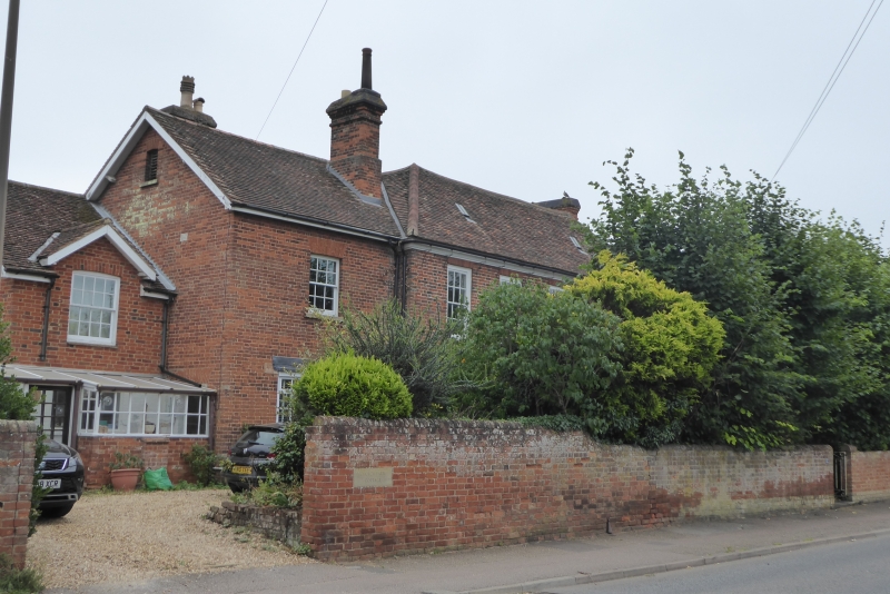
House, now subdivided into 2 properties. Later C18, with C19 alterations and
additions. Red brick with clay tile roofs, that to original block hipped.
Main block 2 storeyed, double-pile plan, with later 2 storeyed blocks to N.
Original block: 5-window range, mostly original flush sashes with glazing
bars, but 2 ground floor RH ones C19 with marginal lights. Gauged brick flat
heads to all windows. Central doorway has door of 4 moulded panels,
rectangular fanlight, fluted pilasters and moulded cornice. Brick band at
first floor level. Moulded wood eaves cornice. Red brick integral stacks
to both sides. N block (No.85) C19, with variety of windows, itself extended
to N C20 with lower 2-storeyed block.
Listing NGR: TL1861341305
External links are from the relevant listing authority and, where applicable, Wikidata. Wikidata IDs may be related buildings as well as this specific building. If you want to add or update a link, you will need to do so by editing the Wikidata entry.


Other nearby listed buildings
