Approximate Location Map
Large Map »
Latitude: 52.1253 / 52°7'31"N
Longitude: -0.5403 / 0°32'24"W
OS Eastings: 500028
OS Northings: 248448
OS Grid: TL000484
Mapcode National: GBR G22.N7C
Mapcode Global: VHFQ6.LV73
Plus Code: 9C4X4FG5+4V
Entry Name: Barn at Rushey Ford House
Listing Date: 27 August 1987
Grade: II
Source: Historic England
Source ID: 1114288
English Heritage Legacy ID: 36991
ID on this website: 101114288
Location: Bedford, Bedfordshire, MK43
County: Bedford
Civil Parish: Kempston Rural
Traditional County: Bedfordshire
Lieutenancy Area (Ceremonial County): Bedfordshire
Church of England Parish: Kempston
Church of England Diocese: St.Albans
Tagged with: Barn
KEMPSTON RURAL WEST END ROAD
TL 04NW
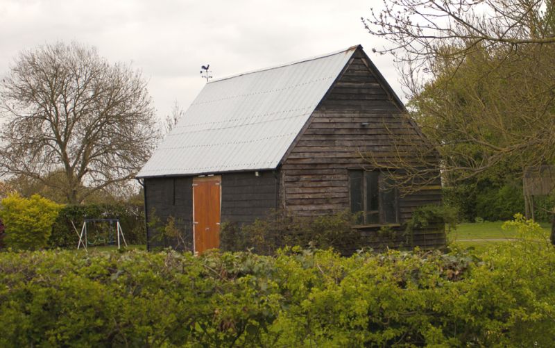
11/220 Barn at Rushey Ford House
-
GV II
C18 timber-framed and weatherboarded barn on coursed limestone rubble plinth.
Corrugated iron roof. Included for group value with house.
Listing NGR: TL0002848448
External links are from the relevant listing authority and, where applicable, Wikidata. Wikidata IDs may be related buildings as well as this specific building. If you want to add or update a link, you will need to do so by editing the Wikidata entry.


Other nearby listed buildings
