Approximate Location Map
Large Map »
Latitude: 52.0287 / 52°1'43"N
Longitude: -0.4945 / 0°29'40"W
OS Eastings: 503382
OS Northings: 237765
OS Grid: TL033377
Mapcode National: GBR G39.V2L
Mapcode Global: VHFQT.C8XN
Plus Code: 9C4X2GH4+F5
Entry Name: 63, Dunstable Street
Listing Date: 16 March 1972
Grade: II
Source: Historic England
Source ID: 1114459
English Heritage Legacy ID: 37389
ID on this website: 101114459
Location: Ampthill, Central Bedfordshire, MK45
County: Central Bedfordshire
Civil Parish: Ampthill
Built-Up Area: Ampthill
Traditional County: Bedfordshire
Lieutenancy Area (Ceremonial County): Bedfordshire
Church of England Parish: Ampthill
Church of England Diocese: St.Albans
Tagged with: Building
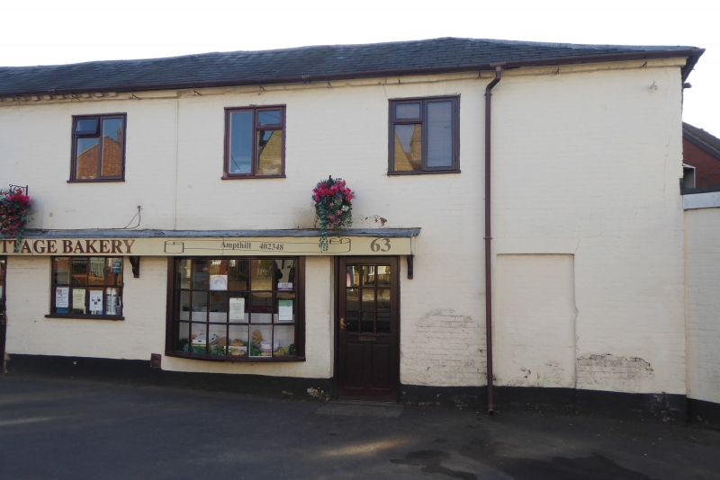
1.
774 DUNSTABLE STREET
(East Side)
No 63
TL 0337 1/60
II
2.
Late C18 small 2-storey terrace houses of vermillion and blue chequered
brick. Hipped slate roof. 2 C19 shop windows. Front now whitewashed.
Listing NGR: TL0338237765
External links are from the relevant listing authority and, where applicable, Wikidata. Wikidata IDs may be related buildings as well as this specific building. If you want to add or update a link, you will need to do so by editing the Wikidata entry.


Other nearby listed buildings
