Approximate Location Map
Large Map »
Latitude: 51.9185 / 51°55'6"N
Longitude: -0.6048 / 0°36'17"W
OS Eastings: 496049
OS Northings: 225356
OS Grid: SP960253
Mapcode National: GBR F35.PX0
Mapcode Global: VHFRB.G1LM
Plus Code: 9C3XW99W+93
Entry Name: Eggington House
Listing Date: 29 April 1952
Grade: II*
Source: Historic England
Source ID: 1114682
English Heritage Legacy ID: 35952
ID on this website: 101114682
Location: Eggington, Central Bedfordshire, LU7
County: Central Bedfordshire
Civil Parish: Eggington
Traditional County: Bedfordshire
Lieutenancy Area (Ceremonial County): Bedfordshire
Church of England Parish: Eggington
Church of England Diocese: St.Albans
Tagged with: English country house
1.
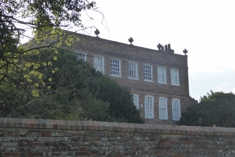
5125 EGGINGTON MILL ROAD
Eggington House
SP 92 NE 17/121 29.4.52
II*
2.
Circa 1696. Red brick. flipped old tile roof with panelled parapet. Basement
and 3 storeys with bands at floor levels. Seven sash windows with segmental arches,
ground and first floor flush frame, original glazing bars. Carved bracket, to
doorhood.
Listing NGR: SP9604925356
External links are from the relevant listing authority and, where applicable, Wikidata. Wikidata IDs may be related buildings as well as this specific building. If you want to add or update a link, you will need to do so by editing the Wikidata entry.


Other nearby listed buildings
