Approximate Location Map
Large Map »
Latitude: 51.8959 / 51°53'45"N
Longitude: -0.5561 / 0°33'22"W
OS Eastings: 499449
OS Northings: 222917
OS Grid: SP994229
Mapcode National: GBR F3M.473
Mapcode Global: VHFRC.9LVY
Plus Code: 9C3XVCWV+9H
Entry Name: Lane Farmhouse
Listing Date: 26 September 1980
Grade: II
Source: Historic England
Source ID: 1114708
English Heritage Legacy ID: 36020
ID on this website: 101114708
Location: Sewell, Central Bedfordshire, LU6
County: Central Bedfordshire
Civil Parish: Houghton Regis
Traditional County: Bedfordshire
Lieutenancy Area (Ceremonial County): Bedfordshire
Church of England Parish: Houghton Regis
Church of England Diocese: St.Albans
Tagged with: Farmhouse
1.
5125 HOUGHTON REGIS SEWELL LANE
(north-west side)
Sewell
SP 9922 29/206 Lane Farmhouse
II GV
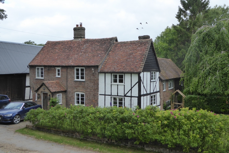
2.
C17 and C19. C17 part timber-framed with whitewashed brick nogging. Two storeys.
Old clay tile roof. Weatherboarding in gable end. Modern casements. Cl? section
slightly higher. Red brick. Clay tile roof. Three casement windows. Gabled
porch. Central stack.
Listing NGR: SP9944922917
External links are from the relevant listing authority and, where applicable, Wikidata. Wikidata IDs may be related buildings as well as this specific building. If you want to add or update a link, you will need to do so by editing the Wikidata entry.


Other nearby listed buildings
