Approximate Location Map
Large Map »
Latitude: 51.949 / 51°56'56"N
Longitude: -0.5312 / 0°31'52"W
OS Eastings: 501047
OS Northings: 228858
OS Grid: TL010288
Mapcode National: GBR G46.QJD
Mapcode Global: VHFR5.R81P
Plus Code: 9C3XWFX9+JG
Entry Name: 4, 6 and 8, Conger Lane
Listing Date: 26 September 1980
Grade: II
Source: Historic England
Source ID: 1114743
English Heritage Legacy ID: 36103
ID on this website: 101114743
Location: Toddington, Central Bedfordshire, LU5
County: Central Bedfordshire
Civil Parish: Toddington
Built-Up Area: Toddington
Traditional County: Bedfordshire
Lieutenancy Area (Ceremonial County): Bedfordshire
Church of England Parish: Toddington
Church of England Diocese: St.Albans
Tagged with: Building
1.
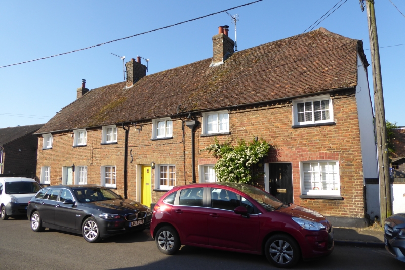
5125 TODDINGTON CONGER LANE
(south side)
Nos 4, 6 and 8
TL 0128 21/318
II
2.
C18. Red brick with later alterations. Two storeys. Half-hipped old clay tile
roof. Six Yorkshire casements.
Listing NGR: TL0104728858
External links are from the relevant listing authority and, where applicable, Wikidata. Wikidata IDs may be related buildings as well as this specific building. If you want to add or update a link, you will need to do so by editing the Wikidata entry.


Other nearby listed buildings
