Approximate Location Map
Large Map »
Latitude: 51.4006 / 51°24'2"N
Longitude: -2.3002 / 2°18'0"W
OS Eastings: 379213
OS Northings: 166882
OS Grid: ST792668
Mapcode National: GBR 0QD.19J
Mapcode Global: VH96N.22V4
Plus Code: 9C3VCM2X+6W
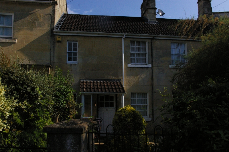
Entry Name: 45, High Street
Listing Date: 19 October 1983
Grade: II
Source: Historic England
Source ID: 1115280
English Heritage Legacy ID: 32226
ID on this website: 101115280
Location: Bathford, Bath and North East Somerset, Somerset, BA1
County: Bath and North East Somerset
Civil Parish: Bathford
Built-Up Area: Bath
Traditional County: Somerset
Lieutenancy Area (Ceremonial County): Somerset
Tagged with: Building
ST 7866-7966 BATHFORD C.P. HIGH STREET
(North-east side)
9/56
No. 45
G.V.
II
House. Late C18th. Ashlar; slate roof; central ashlar stack. 2 storeys.
3 bays. Glazing bar sash windows. Modern porch, off centre to left. Included
for group value.
Listing NGR: ST7921366882
External links are from the relevant listing authority and, where applicable, Wikidata. Wikidata IDs may be related buildings as well as this specific building. If you want to add or update a link, you will need to do so by editing the Wikidata entry.


Other nearby listed buildings
