Approximate Location Map
Large Map »
Latitude: 51.75 / 51°45'0"N
Longitude: -1.2486 / 1°14'54"W
OS Eastings: 451970
OS Northings: 205970
OS Grid: SP519059
Mapcode National: GBR 8Z4.94M
Mapcode Global: VHCXV.98SS
Plus Code: 9C3WQQ22+2H
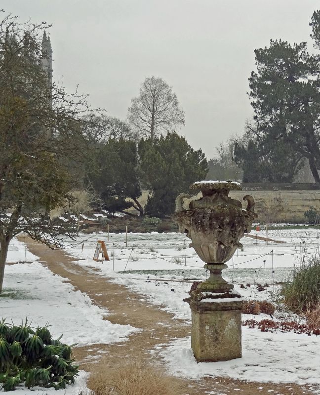
Entry Name: Vase at the South End of the Main Walk
Listing Date: 28 June 1972
Grade: II
Source: Historic England
Source ID: 1115516
English Heritage Legacy ID: 245501
ID on this website: 101115516
Location: University Botanical Garden, Oxford, Oxfordshire, OX1
County: Oxfordshire
District: Oxford
Electoral Ward/Division: Holywell
Parish: Non Civil Parish
Built-Up Area: Oxford
Traditional County: Oxfordshire
Lieutenancy Area (Ceremonial County): Oxfordshire
Tagged with: Building
HIGH STREET
1.
1485
(South Side)
Botanic Gardens
Vase at the South end
of the Main Walk
SP 5105 NE 13/421A
II
2.
C18. Stone vase on plinth forming the terminal feature of the main garden
walk.
All the listed buildings on the South Side form a group.
Listing NGR: SP5197005970
External links are from the relevant listing authority and, where applicable, Wikidata. Wikidata IDs may be related buildings as well as this specific building. If you want to add or update a link, you will need to do so by editing the Wikidata entry.


Other nearby listed buildings
