Approximate Location Map
Large Map »
Latitude: 51.1094 / 51°6'33"N
Longitude: 0.4594 / 0°27'33"E
OS Eastings: 572260
OS Northings: 137332
OS Grid: TQ722373
Mapcode National: GBR PT2.8ZN
Mapcode Global: VHJN4.XC7W
Plus Code: 9F324F55+QQ
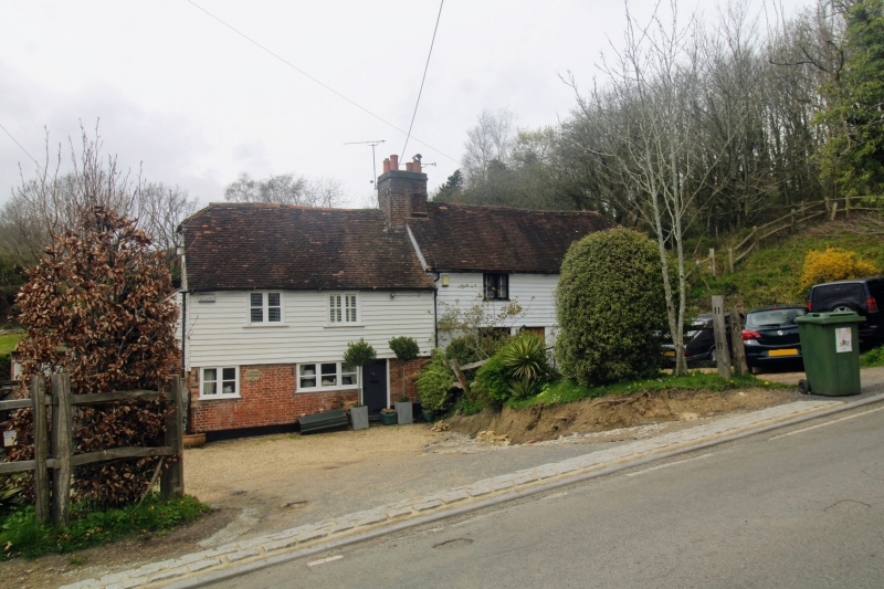
Entry Name: Underhill Cottages
Listing Date: 22 June 1989
Grade: II
Source: Historic England
Source ID: 1116111
English Heritage Legacy ID: 169421
ID on this website: 101116111
Location: Goudhurst, Tunbridge Wells, Kent, TN17
County: Kent
District: Tunbridge Wells
Civil Parish: Goudhurst
Built-Up Area: Goudhurst
Traditional County: Kent
Lieutenancy Area (Ceremonial County): Kent
Tagged with: Cottage
GOUDHURST BALCOMBES HILL
TQ 7237-7337 (south west side)
15/71 Underhill Cottages
- II
Cottage pair. C17 and C18. Timber framed and weather-boarded on red brick ground
floor with plain tiled roof. Two storeys on rendered plinth with half-hipped
roof, that to right stepped up at centre left by large ridge stack. Five wooden
casements on first floor and 4 on ground floor with boarded doors to centre left
and to centre right.
Listing NGR: TQ7226037332
External links are from the relevant listing authority and, where applicable, Wikidata. Wikidata IDs may be related buildings as well as this specific building. If you want to add or update a link, you will need to do so by editing the Wikidata entry.


Other nearby listed buildings
