Approximate Location Map
Large Map »
Latitude: 51.3176 / 51°19'3"N
Longitude: 0.8927 / 0°53'33"E
OS Eastings: 601671
OS Northings: 161582
OS Grid: TR016615
Mapcode National: GBR SW3.BJ4
Mapcode Global: VHKJW.F48S
Plus Code: 9F328V9V+23
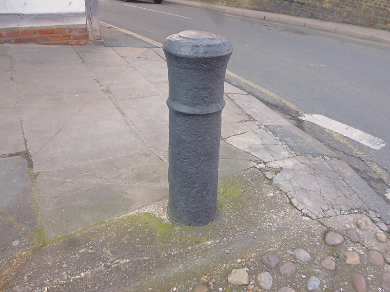
Entry Name: Bollard Within the Curtilage of No 25 on the Corner of Court Street and Quay Lane
Listing Date: 3 August 1972
Grade: II
Source: Historic England
Source ID: 1116328
English Heritage Legacy ID: 175899
ID on this website: 101116328
Location: Faversham, Swale, Kent, ME13
County: Kent
District: Swale
Civil Parish: Faversham
Built-Up Area: Faversham
Traditional County: Kent
Lieutenancy Area (Ceremonial County): Kent
Tagged with: Bollard
COURT STREET
1.
ll03 (West Side)
-----------
Bollard Within the
curtilage of No 25 on
the corner of Court Street
and Quay Lane
TR 0161 NE 1/29B
II
2.
Late C17 or early C18 cannon used as a bollard.
Listing NGR: TR0167461582
External links are from the relevant listing authority and, where applicable, Wikidata. Wikidata IDs may be related buildings as well as this specific building. If you want to add or update a link, you will need to do so by editing the Wikidata entry.


Other nearby listed buildings
