Approximate Location Map
Large Map »
Latitude: 51.7831 / 51°46'58"N
Longitude: -1.2935 / 1°17'36"W
OS Eastings: 448830
OS Northings: 209612
OS Grid: SP488096
Mapcode National: GBR 7XC.3T2
Mapcode Global: VHCXM.JFJZ
Plus Code: 9C3WQPM4+6H
Entry Name: 139, Godstow Road
Listing Date: 28 June 1972
Grade: II
Source: Historic England
Source ID: 1116445
English Heritage Legacy ID: 245448
ID on this website: 101116445
Location: Upper Wolvercote, Oxford, Oxfordshire, OX2
County: Oxfordshire
District: Oxford
Electoral Ward/Division: Wolvercote
Parish: Non Civil Parish
Built-Up Area: Wolvercote
Traditional County: Oxfordshire
Lieutenancy Area (Ceremonial County): Oxfordshire
Church of England Parish: Wolvercote
Church of England Diocese: Oxford
Tagged with: Building
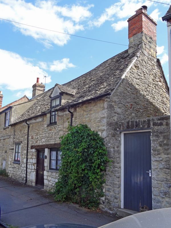
GODSTOW ROAD
1.
1485
(South Side)
No 139
SP 4809 16/12
II
2.
Cottage. C17-C18 l-storeyed coursed rubble with a stone slate roof and
an eaves-level dormer. The end stack is encased in cement and has a modern
red brick shaft. The ground floor has 2 2-light casement windows and
a plain doorway.
Listing NGR: SP4883009612
External links are from the relevant listing authority and, where applicable, Wikidata. Wikidata IDs may be related buildings as well as this specific building. If you want to add or update a link, you will need to do so by editing the Wikidata entry.


Other nearby listed buildings
