Approximate Location Map
Large Map »
Latitude: 52.071 / 52°4'15"N
Longitude: -2.0243 / 2°1'27"W
OS Eastings: 398432
OS Northings: 241402
OS Grid: SO984414
Mapcode National: GBR 2K8.50Q
Mapcode Global: VHB0Y.V6QQ
Plus Code: 9C4V3XCG+97
Entry Name: Cottage Occupied by Knott
Listing Date: 3 August 1972
Grade: II
Source: Historic England
Source ID: 1116605
English Heritage Legacy ID: 443066
ID on this website: 101116605
Location: Elmley Castle, Wychavon, Worcestershire, WR10
County: Worcestershire
District: Wychavon
Civil Parish: Elmley Castle
Built-Up Area: Elmley Castle
Traditional County: Worcestershire
Lieutenancy Area (Ceremonial County): Worcestershire
Church of England Parish: Elmley Castle with Netherton, Bricklehampton, Gt Combrton and Lt Comberton
Church of England Diocese: Worcester
Tagged with: Cottage
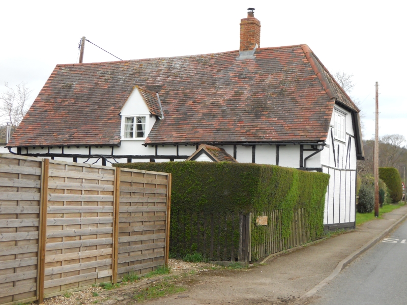
ELMLEY CASTLE ELMLEY CASTLE
1.
2301
Road to Netherton
Cottage occupied by Knott
SO 9841 24/420
II
2.
C17. Timber frame, plaster and whitened brick. Shingle roof with half-hipped
end on to road. Gabled dormers. Modern casements.
Listing NGR: SO9843241402
External links are from the relevant listing authority and, where applicable, Wikidata. Wikidata IDs may be related buildings as well as this specific building. If you want to add or update a link, you will need to do so by editing the Wikidata entry.


Other nearby listed buildings
