Approximate Location Map
Large Map »
Latitude: 52.1014 / 52°6'4"N
Longitude: -2.0046 / 2°0'16"W
OS Eastings: 399783
OS Northings: 244782
OS Grid: SO997447
Mapcode National: GBR 2JX.B05
Mapcode Global: VHB0S.6FMY
Plus Code: 9C4V4X2W+H5
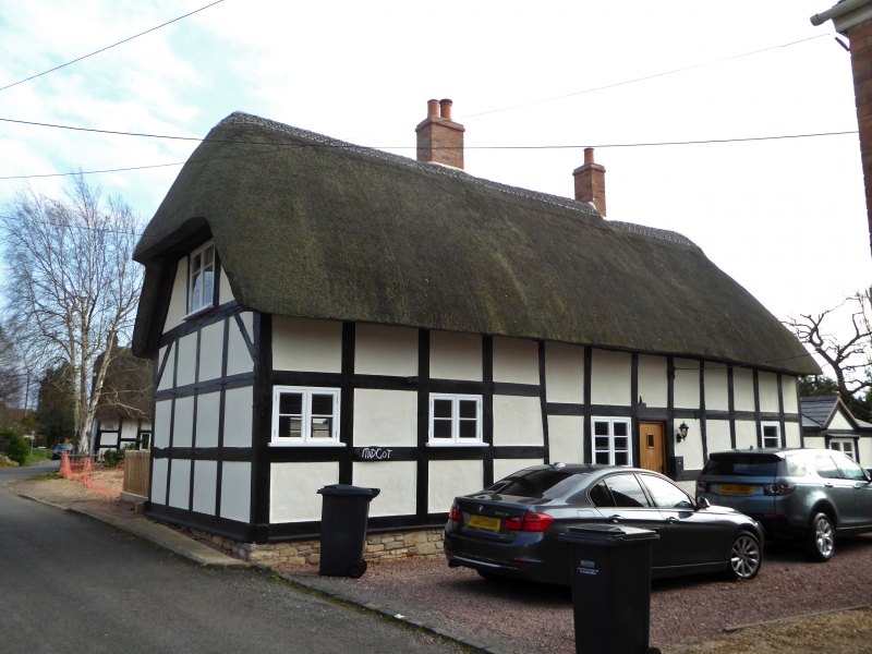
Entry Name: Midcot
Listing Date: 3 August 1972
Grade: II
Source: Historic England
Source ID: 1116895
English Heritage Legacy ID: 442643
ID on this website: 101116895
Location: Cropthorne, Wychavon, Worcestershire, WR10
County: Worcestershire
District: Wychavon
Civil Parish: Cropthorne
Built-Up Area: Cropthorne
Traditional County: Worcestershire
Lieutenancy Area (Ceremonial County): Worcestershire
Church of England Parish: Fladbury, Hill and Moor, Wyre Piddle, Cropthorne and Charlton
Church of England Diocese: Worcester
Tagged with: Building Thatched cottage
CROPTHORNE CROPTHORNE
1.
2301
Main Street
(South East Side)
Midcot
SO 94 SE 14/271
II
2.
Cl7 cottage. Timber frame and plaster and painted brick. Thatch roof.
Modern casements. Gable end on to road.
Listing NGR: SO9978344782
External links are from the relevant listing authority and, where applicable, Wikidata. Wikidata IDs may be related buildings as well as this specific building. If you want to add or update a link, you will need to do so by editing the Wikidata entry.


Other nearby listed buildings
