Approximate Location Map
Large Map »
Latitude: 51.4018 / 51°24'6"N
Longitude: -1.451 / 1°27'3"W
OS Eastings: 438288
OS Northings: 167122
OS Grid: SU382671
Mapcode National: GBR 70H.009
Mapcode Global: VHC20.S1S5
Plus Code: 9C3WCG2X+PJ
Entry Name: Canal Bridge
Listing Date: 21 June 1984
Grade: II
Source: Historic England
Source ID: 1117245
English Heritage Legacy ID: 39733
ID on this website: 101117245
Location: Kintbury, West Berkshire, RG17
County: West Berkshire
Civil Parish: Kintbury
Built-Up Area: Kintbury
Traditional County: Berkshire
Lieutenancy Area (Ceremonial County): Berkshire
Church of England Parish: Kintbury
Church of England Diocese: Oxford
Tagged with: Bridge
SU 36 NE KINTBURY CHURCH STREET
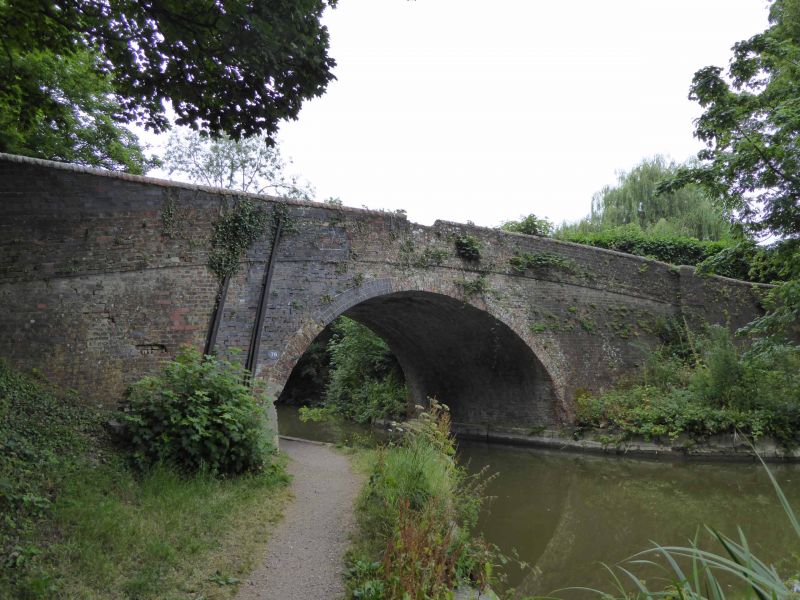
12/19 Canal Bridge
II
Canal bridge. Early C19. Brick, english bond with curved courses and
round capping. Single round arch. Dates probably from c1810 and designed
by John Rennie.
Listing NGR: SU3828867122
External links are from the relevant listing authority and, where applicable, Wikidata. Wikidata IDs may be related buildings as well as this specific building. If you want to add or update a link, you will need to do so by editing the Wikidata entry.


Other nearby listed buildings
