Approximate Location Map
Large Map »
Latitude: 51.4019 / 51°24'6"N
Longitude: -1.2587 / 1°15'31"W
OS Eastings: 451661
OS Northings: 167248
OS Grid: SU516672
Mapcode National: GBR 93D.0KT
Mapcode Global: VHCZL.41F3
Plus Code: 9C3WCP2R+QG
Entry Name: Dibbin Tomb Approximately 8 Metres to North of Vestry of St Mary
Listing Date: 10 November 1983
Grade: II
Source: Historic England
Source ID: 1117286
English Heritage Legacy ID: 39628
ID on this website: 101117286
Location: St Mary's Church, Thatcham, West Berkshire, RG19
County: West Berkshire
Civil Parish: Thatcham
Built-Up Area: Thatcham
Traditional County: Berkshire
Lieutenancy Area (Ceremonial County): Berkshire
Church of England Parish: Thatcham
Church of England Diocese: Oxford
Tagged with: Building
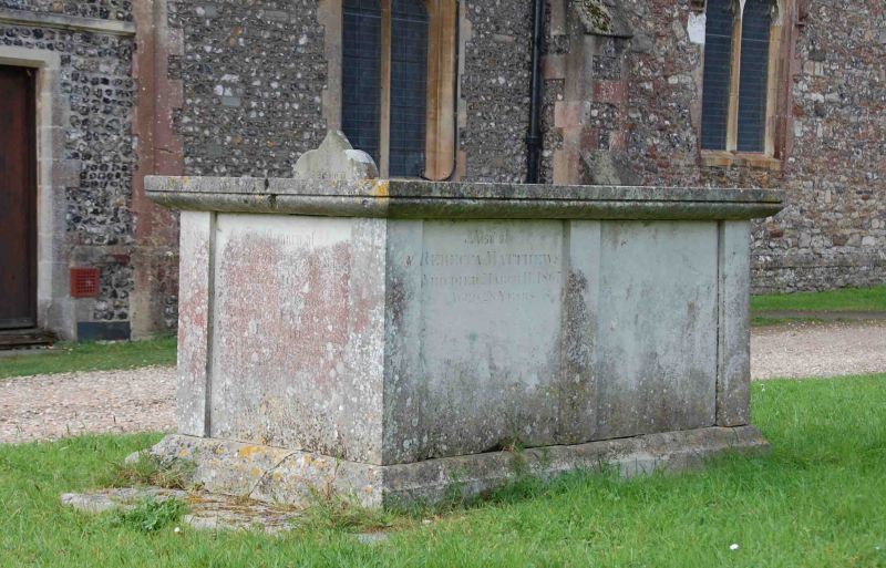
ThATCHAM CHURCH GATE (north side)
SU 5167
8/23 Dibbin Tomb Approximately
8 Metres To North Of Vestry
Of St.Mary
GV II
Chest tomb. 1775. Ashlar. Moulded top and base, panelled sides.
Listing NGR: SU5166167248
External links are from the relevant listing authority and, where applicable, Wikidata. Wikidata IDs may be related buildings as well as this specific building. If you want to add or update a link, you will need to do so by editing the Wikidata entry.


Other nearby listed buildings
