Approximate Location Map
Large Map »
Latitude: 51.4724 / 51°28'20"N
Longitude: -0.913 / 0°54'46"W
OS Eastings: 475592
OS Northings: 175382
OS Grid: SU755753
Mapcode National: GBR C5J.PYX
Mapcode Global: VHDWV.4854
Plus Code: 9C3XF3CP+WQ
Entry Name: Wall South of North Lodge
Listing Date: 17 October 1983
Grade: II
Source: Historic England
Source ID: 1117434
English Heritage Legacy ID: 41200
ID on this website: 101117434
Location: Sonning, Wokingham, Berkshire, RG4
County: Wokingham
Civil Parish: Sonning
Built-Up Area: Woodley
Traditional County: Berkshire
Lieutenancy Area (Ceremonial County): Berkshire
Church of England Parish: Sonning
Church of England Diocese: Oxford
Tagged with: Wall
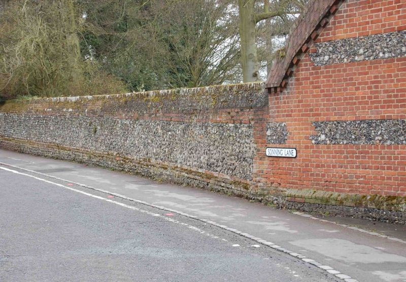
SU 7575 SONNING SONNING LANE
(west side)
14/48 Wall South Of
North Lodge
GV II
Wall. C18 brick and flint wall 2 metres high approximately 80 metres long.
Brick on edge coping. Included for group value.
Listing NGR: SU7559275382
External links are from the relevant listing authority and, where applicable, Wikidata. Wikidata IDs may be related buildings as well as this specific building. If you want to add or update a link, you will need to do so by editing the Wikidata entry.


Other nearby listed buildings
