Approximate Location Map
Large Map »
Latitude: 51.766 / 51°45'57"N
Longitude: -0.9286 / 0°55'42"W
OS Eastings: 474032
OS Northings: 208021
OS Grid: SP740080
Mapcode National: GBR C21.62F
Mapcode Global: VHDV8.VWG2
Plus Code: 9C3XQ38C+9H
Entry Name: Brewers
Listing Date: 11 October 1985
Grade: II
Source: Historic England
Source ID: 1118260
English Heritage Legacy ID: 43166
ID on this website: 101118260
Location: Church End, Buckinghamshire, HP17
County: Buckinghamshire
Civil Parish: Haddenham
Built-Up Area: Haddenham
Traditional County: Buckinghamshire
Lieutenancy Area (Ceremonial County): Buckinghamshire
Church of England Parish: Haddenham
Church of England Diocese: Oxford
Tagged with: Building
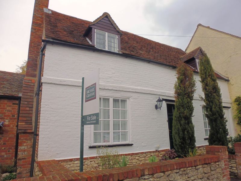
SP 7408 HADDENHAM FLINT STREET
(north side)
11/225 No.6 (Brewers)
-
- II
House. C18. Colourwashed brick. Rendered plinth. Old tile roof.
3 bays and 1½ storeys. Central 6-panel door. 2-light casements. Band
course and 2-light leaded casemented gabled eaves dormers to outer bays.
Left hand stack. 1 storey outbuilding and garage to left.
Listing NGR: SP7403308021
External links are from the relevant listing authority and, where applicable, Wikidata. Wikidata IDs may be related buildings as well as this specific building. If you want to add or update a link, you will need to do so by editing the Wikidata entry.


Other nearby listed buildings
