Approximate Location Map
Large Map »
Latitude: 50.8002 / 50°48'0"N
Longitude: -1.992 / 1°59'31"W
OS Eastings: 400662
OS Northings: 100067
OS Grid: SU006000
Mapcode National: GBR 31M.M7K
Mapcode Global: FRA 66QZ.7T6
Plus Code: 9C2WR225+36
Entry Name: Stable Block at Rear of Green Man Inn
Listing Date: 2 February 1983
Grade: II
Source: Historic England
Source ID: 1119523
English Heritage Legacy ID: 107139
ID on this website: 101119523
Location: Wimborne Minster, Dorset, BH21
County: Dorset
Civil Parish: Wimborne Minster
Built-Up Area: Wimborne Minster
Traditional County: Dorset
Lieutenancy Area (Ceremonial County): Dorset
Church of England Parish: Wimborne Minster St Cuthberga
Church of England Diocese: Salisbury
Tagged with: Stable
VICTORIA ROAD
1.
5193
(west side)
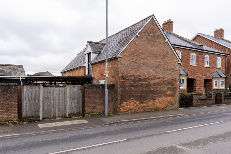
Stable block at rear
of Green Man Inn
SU 0000 SE 2/115
II GV
2.
Probably C19. Brick walls, slate roof. One storey and attics. Ground floor has
large garage doors, probably original stable entrance, One flush door and one
blocked window. Attic has half-dormer with former hay-loft door.
Listing NGR: SU0066200067
External links are from the relevant listing authority and, where applicable, Wikidata. Wikidata IDs may be related buildings as well as this specific building. If you want to add or update a link, you will need to do so by editing the Wikidata entry.


Other nearby listed buildings
