Approximate Location Map
Large Map »
Latitude: 51.1598 / 51°9'35"N
Longitude: 0.6822 / 0°40'55"E
OS Eastings: 587649
OS Northings: 143481
OS Grid: TQ876434
Mapcode National: GBR QV3.C8X
Mapcode Global: VHJN2.S30Q
Plus Code: 9F325M5J+WV
Entry Name: Hegg Hill Barn
Listing Date: 10 October 1980
Grade: II
Source: Historic England
Source ID: 1119645
English Heritage Legacy ID: 181254
ID on this website: 101119645
Location: The Quarter, Ashford, Kent, TN27
County: Kent
District: Ashford
Civil Parish: Smarden
Traditional County: Kent
Lieutenancy Area (Ceremonial County): Kent
Tagged with: Building
This list entry was subject to a Minor Amendment on 1 September 2023 to update the name and address and to reformat the text to current standards
TQ 84 SE
13/49A
SMARDEN
SMARDEN BELL ROAD
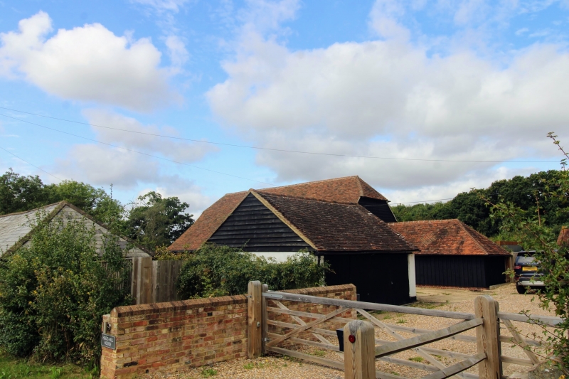
Hegg Hill Barn
(Formerly listed as Weatherboarded barn to south-west of Hegg Hill)
II
Probably C18. Large weatherboarded barn with half-hipped tiled roof.
Listing NGR: TQ8842444202
External links are from the relevant listing authority and, where applicable, Wikidata. Wikidata IDs may be related buildings as well as this specific building. If you want to add or update a link, you will need to do so by editing the Wikidata entry.


Other nearby listed buildings
