Approximate Location Map
Large Map »
Latitude: 54.6534 / 54°39'12"N
Longitude: -1.4494 / 1°26'57"W
OS Eastings: 435622
OS Northings: 528835
OS Grid: NZ356288
Mapcode National: GBR LGBM.0P
Mapcode Global: WHD6H.Q90H
Plus Code: 9C6WMH32+86
Entry Name: Churchyard Wall, 40 Metres West of Church of St Edmund Churchyard Wall, 50 Metres South West of Church of St Edmund
Listing Date: 24 February 1986
Grade: II
Source: Historic England
Source ID: 1121483
English Heritage Legacy ID: 112150
ID on this website: 101121483
Location: St Edmund's Church, Sedgefield, County Durham, TS21
County: County Durham
Civil Parish: Sedgefield
Built-Up Area: Sedgefield
Traditional County: Durham
Lieutenancy Area (Ceremonial County): County Durham
Church of England Parish: Upper Skerne
Church of England Diocese: Durham
Tagged with: Churchyard wall
NZ 3528 SEDGEFIELD FRONT STREET
(South side, off)
13/37 Churchyard wall,
40 metres west of
Church of St. Edmund
GV II
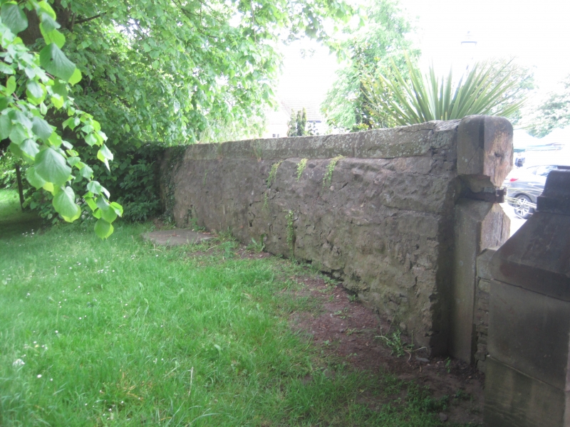
Churchyard wall. Possibly C17. Rubble wall with dressed quoins. L-plan facing
The Square (to west) and Rectory Row (to south). West section, between 1.5 and
2.0 metres high, has chamfered, roll-moulded coping, runs south for about 50
metres and is interrupted, to north of centre, by lych gate. South section, of
similar height, runs east (along Rectory Row) for about 110 metres and terminates
at western return of the Workingmen's Club. The 12-metre west section of this
wall has chamfered, roll-moulded coping; the remainder, partly rebuilt, has flat
coping. Included for group value.
Listing NGR: NZ3562228835
External links are from the relevant listing authority and, where applicable, Wikidata. Wikidata IDs may be related buildings as well as this specific building. If you want to add or update a link, you will need to do so by editing the Wikidata entry.


Other nearby listed buildings
