Approximate Location Map
Large Map »
Latitude: 51.7522 / 51°45'7"N
Longitude: -1.2602 / 1°15'36"W
OS Eastings: 451165
OS Northings: 206206
OS Grid: SP511062
Mapcode National: GBR 8Z4.074
Mapcode Global: VHCXV.37N2
Plus Code: 9C3WQP2Q+VW
Entry Name: Gateway to College of Further Education
Listing Date: 28 June 1972
Grade: II
Source: Historic England
Source ID: 1121520
English Heritage Legacy ID: 245679
ID on this website: 101121520
Location: Oxford, Oxfordshire, OX1
County: Oxfordshire
District: Oxford
Electoral Ward/Division: Carfax
Parish: Non Civil Parish
Built-Up Area: Oxford
Traditional County: Oxfordshire
Lieutenancy Area (Ceremonial County): Oxfordshire
Church of England Parish: Oxford St Ebbe with Holy Trinity and St Peter le Bailey
Church of England Diocese: Oxford
Tagged with: Gate
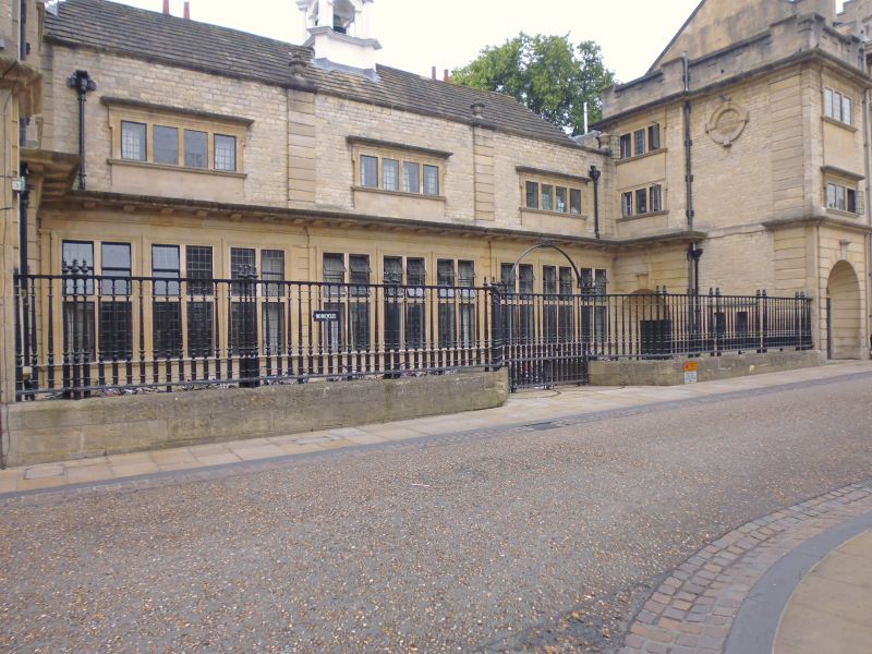
NEW INN HALL STREET
1.
1485
(West Side)
Gateway to College of
Further Education
SP 5106 SW 8/778A
II
2.
1901. Pair of cast-iron gates with overthrow.
Listing NGR: SP5116506206
External links are from the relevant listing authority and, where applicable, Wikidata. Wikidata IDs may be related buildings as well as this specific building. If you want to add or update a link, you will need to do so by editing the Wikidata entry.


Other nearby listed buildings
