Approximate Location Map
Large Map »
Latitude: 52.6508 / 52°39'2"N
Longitude: -0.1414 / 0°8'28"W
OS Eastings: 525832
OS Northings: 307516
OS Grid: TF258075
Mapcode National: GBR HYW.T7W
Mapcode Global: WHHN6.SMWP
Plus Code: 9C4XMV25+8F
Entry Name: St Vincent's Cross
Listing Date: 15 December 1955
Grade: II
Source: Historic England
Source ID: 1126726
English Heritage Legacy ID: 50188
ID on this website: 101126726
Location: Peterborough, Cambridgeshire, PE6
County: City of Peterborough
Civil Parish: Thorney
Traditional County: Lincolnshire
Lieutenancy Area (Ceremonial County): Cambridgeshire
Church of England Parish: Thorney Abbey St Mary and St Botolph
Church of England Diocese: Peterborough
Tagged with: Monument
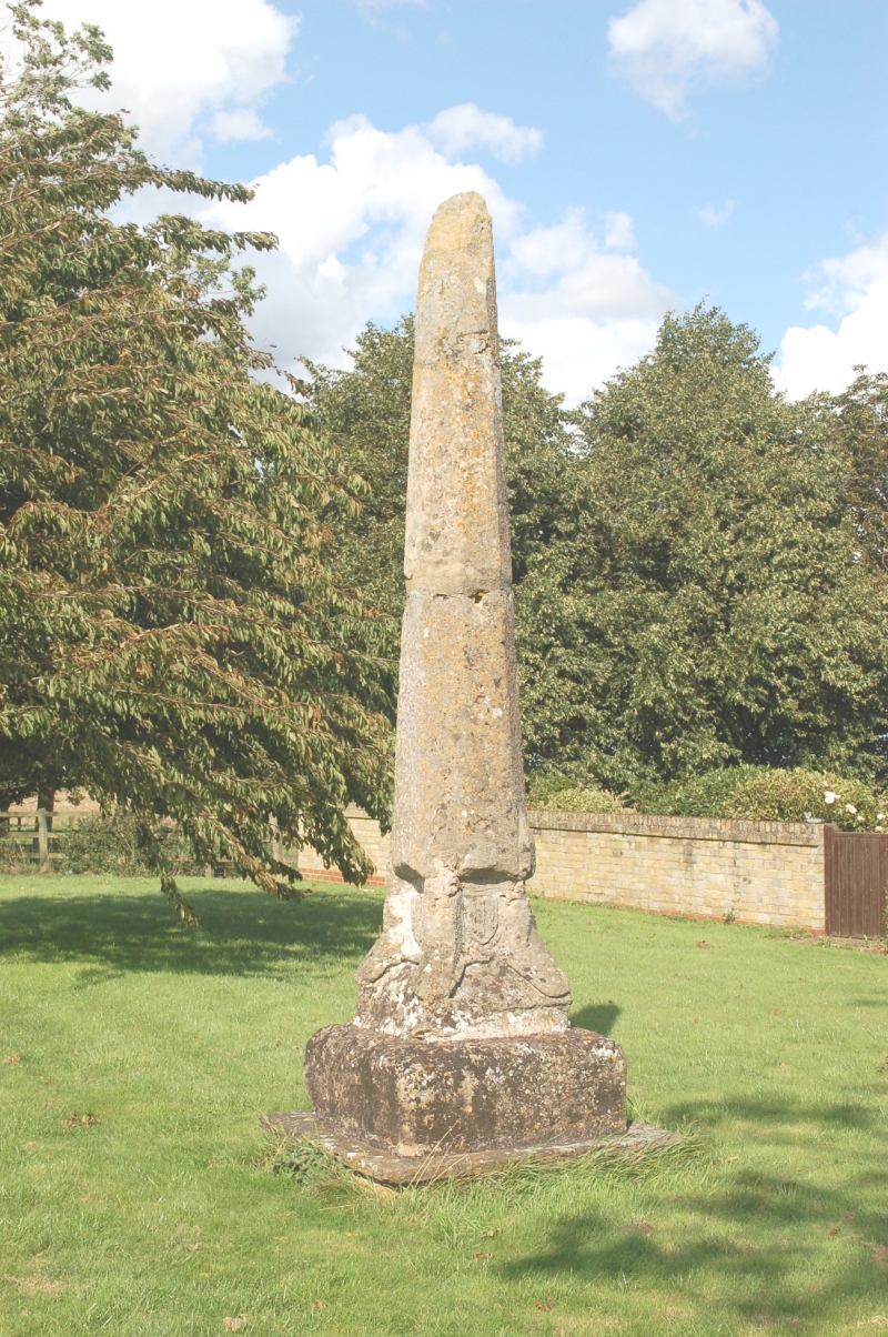
1.
5141 NEWBOROUGH CROWLAND ROAD
St Vincent's Cross
TF 20 NE 6/584 15.12.55
II
2.
Medieval stone cross. C15. Tapered octagonal shaft splayed out at base
to form 4 feet with shield in recessed panel between on each side. Stands
on square base. The head is missing.
Listing NGR: TF2583207516
External links are from the relevant listing authority and, where applicable, Wikidata. Wikidata IDs may be related buildings as well as this specific building. If you want to add or update a link, you will need to do so by editing the Wikidata entry.


Other nearby listed buildings
