Approximate Location Map
Large Map »
Latitude: 51.4398 / 51°26'23"N
Longitude: -2.8386 / 2°50'18"W
OS Eastings: 341810
OS Northings: 171534
OS Grid: ST418715
Mapcode National: GBR JD.NGPN
Mapcode Global: VH7C7.R26L
Plus Code: 9C3VC5Q6+WH
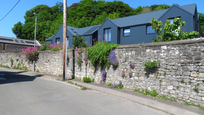
Entry Name: Wall Along Road at Clevedon Court
Listing Date: 22 January 1976
Grade: II
Source: Historic England
Source ID: 1129656
English Heritage Legacy ID: 33023
ID on this website: 101129656
Location: East Clevedon, North Somerset, BS21
County: North Somerset
Civil Parish: Clevedon
Built-Up Area: Clevedon
Traditional County: Somerset
Lieutenancy Area (Ceremonial County): Somerset
Tagged with: Wall
ST 4171 1/1J
ST 47 SW 3/1J
ALL SAINTS' LANE (East Side)
Wall along road at Clevedon Court,Tickenham Road
GV
II
This wall has a section which is returned north into All Saints' Lane. See under Tickenham Road.
The Fountain, The Pier including the Tollhouse, Marine Parade, and Nos 19 and 20
The Beach form a group.
Listing NGR: ST4181071534
External links are from the relevant listing authority and, where applicable, Wikidata. Wikidata IDs may be related buildings as well as this specific building. If you want to add or update a link, you will need to do so by editing the Wikidata entry.


Other nearby listed buildings
