Approximate Location Map
Large Map »
Latitude: 53.8101 / 53°48'36"N
Longitude: -1.7763 / 1°46'34"W
OS Eastings: 414827
OS Northings: 434894
OS Grid: SE148348
Mapcode National: GBR JDC.4Q
Mapcode Global: WHC98.PHBF
Plus Code: 9C5WR66F+3F
Entry Name: St Luke's Sunday School
Listing Date: 9 August 1983
Grade: II
Source: Historic England
Source ID: 1133653
English Heritage Legacy ID: 337287
ID on this website: 101133653
Location: Manningham, Bradford, West Yorkshire, BD9
County: Bradford
Electoral Ward/Division: Manningham
Parish: Non Civil Parish
Built-Up Area: Bradford
Traditional County: Yorkshire
Lieutenancy Area (Ceremonial County): West Yorkshire
Church of England Parish: Manningham St Paul and St Jude
Church of England Diocese: Leeds
Tagged with: Sunday school School building
1.
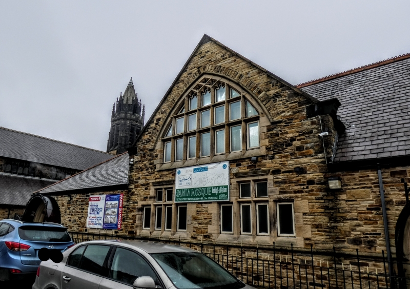
5111 VICTOR ROAD
Heaton BD9
St Luke's Sunday School
SE 1434 NE 27/1268
II GV
2.
Circa 1881. T H and F Healy. Sunday School in similar style to church. Gable end
to road. Broad, freely handled Perpendicular tracery windows.
Listing NGR: SE1482734894
External links are from the relevant listing authority and, where applicable, Wikidata. Wikidata IDs may be related buildings as well as this specific building. If you want to add or update a link, you will need to do so by editing the Wikidata entry.


Other nearby listed buildings
