Approximate Location Map
Large Map »
Latitude: 53.669 / 53°40'8"N
Longitude: -1.8191 / 1°49'8"W
OS Eastings: 412049
OS Northings: 419186
OS Grid: SE120191
Mapcode National: GBR HVQ0.ZH
Mapcode Global: WHCB1.111L
Plus Code: 9C5WM59J+J9
Entry Name: The Store
Listing Date: 29 September 1978
Grade: II
Source: Historic England
Source ID: 1134339
English Heritage Legacy ID: 339624
ID on this website: 101134339
Location: Ainley Top, Kirklees, West Yorkshire, HD2
County: Kirklees
Electoral Ward/Division: Lindley
Parish: Non Civil Parish
Traditional County: Yorkshire
Lieutenancy Area (Ceremonial County): West Yorkshire
Church of England Parish: Birchencliffe St Philip the Apostle
Church of England Diocese: Leeds
Tagged with: Architectural structure
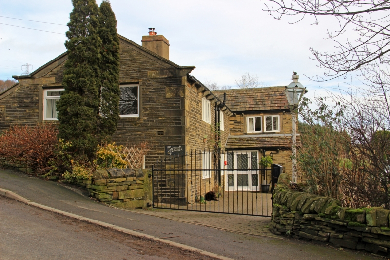
BURN ROAD
1.
5113
(East Side)
Birchencliffe
No 110 (The Store)
SE 1219 16/278
II
2.
C18. Hammer-dressed stone. Pitched stone slate roof. Coped gables on cut
kneelers. 2 storeys. Stone brackets to gutter. L-shaped plan. Catslide
roof to rear. Modern casements.
Listing NGR: SE1204919186
External links are from the relevant listing authority and, where applicable, Wikidata. Wikidata IDs may be related buildings as well as this specific building. If you want to add or update a link, you will need to do so by editing the Wikidata entry.


Other nearby listed buildings
