Approximate Location Map
Large Map »
Latitude: 53.6763 / 53°40'34"N
Longitude: -1.7732 / 1°46'23"W
OS Eastings: 415077
OS Northings: 420001
OS Grid: SE150200
Mapcode National: GBR JT1X.WW
Mapcode Global: WHC9V.QVSL
Plus Code: 9C5WM6GG+GP
Entry Name: Barn at Fell Greave Farm
Listing Date: 29 September 1978
Grade: II
Source: Historic England
Source ID: 1134363
English Heritage Legacy ID: 339579
ID on this website: 101134363
Location: Netheroyd Hill, Kirklees, West Yorkshire, HD2
County: Kirklees
Electoral Ward/Division: Ashbrow
Parish: Non Civil Parish
Built-Up Area: Huddersfield
Traditional County: Yorkshire
Lieutenancy Area (Ceremonial County): West Yorkshire
Church of England Parish: Bradley St Thomas
Church of England Diocese: Leeds
Tagged with: Barn
BRADFORD ROAD
1.
5113
(East Side)
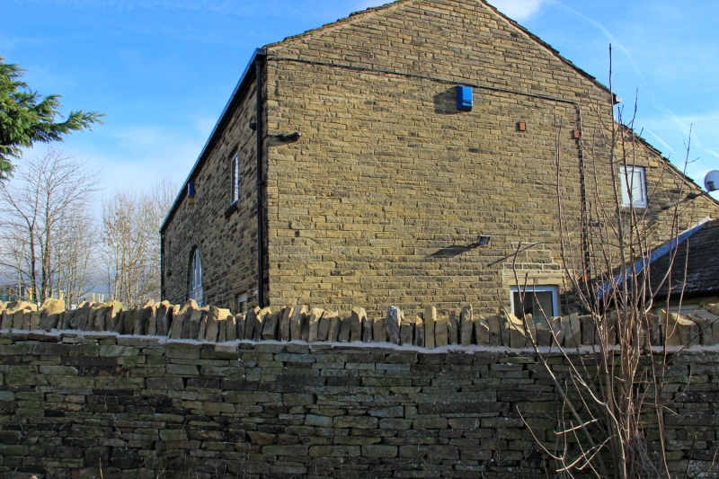
Barn at Fell Greave Farm
SE 1520 11/229
SE 1519 17/229
II GV
2.
C19. Hammer-dressed stone. Pitched stone slate roof. One arched doorway
on each side. Outshut with cattle mistals on south side. Extensions with
cart sheds to south-east and south-west.
Listing NGR: SE1507720001
External links are from the relevant listing authority and, where applicable, Wikidata. Wikidata IDs may be related buildings as well as this specific building. If you want to add or update a link, you will need to do so by editing the Wikidata entry.


Other nearby listed buildings
