Approximate Location Map
Large Map »
Latitude: 53.5559 / 53°33'21"N
Longitude: -1.8218 / 1°49'18"W
OS Eastings: 411905
OS Northings: 406595
OS Grid: SE119065
Mapcode National: GBR HWQB.D1
Mapcode Global: WHCBD.ZWND
Plus Code: 9C5WH54H+87
Entry Name: 224, Woodhead Road
Listing Date: 4 August 1983
Grade: II
Source: Historic England
Source ID: 1134739
English Heritage Legacy ID: 340639
ID on this website: 101134739
Location: Holmbridge, Kirklees, West Yorkshire, HD9
County: Kirklees
Civil Parish: Holme Valley
Traditional County: Yorkshire
Lieutenancy Area (Ceremonial County): West Yorkshire
Church of England Parish: Holmbridge St David
Church of England Diocese: Leeds
Tagged with: Building
SE 10 NW
4/411
WOODHEAD ROAD
(Holmbridge)
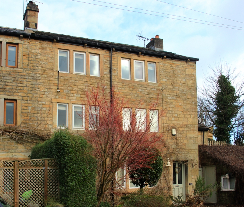
No 224
II
End of terrace. Late C18 or early C19. Hammer dressed stone. Quoins. Stone slate
roof with moulded stone brackets. Three storeys. Two bays with entrance to right.
Two-light windows to ground floor. Three-light windows to first and second floors.
Listing NGR: SE1190506595
External links are from the relevant listing authority and, where applicable, Wikidata. Wikidata IDs may be related buildings as well as this specific building. If you want to add or update a link, you will need to do so by editing the Wikidata entry.


Other nearby listed buildings
