Approximate Location Map
Large Map »
Latitude: 53.5636 / 53°33'48"N
Longitude: -1.78 / 1°46'48"W
OS Eastings: 414665
OS Northings: 407464
OS Grid: SE146074
Mapcode National: GBR JW07.F8
Mapcode Global: WHCBF.MPKF
Plus Code: 9C5WH679+CX
Entry Name: 57, Under Bank Old Road
Listing Date: 4 August 1983
Grade: II
Source: Historic England
Source ID: 1134760
English Heritage Legacy ID: 340589
ID on this website: 101134760
Location: Under Bank, Kirklees, West Yorkshire, HD9
County: Kirklees
Civil Parish: Holme Valley
Built-Up Area: Holmfirth
Traditional County: Yorkshire
Lieutenancy Area (Ceremonial County): West Yorkshire
Church of England Parish: Holmfirth Holy Trinity
Church of England Diocese: Leeds
Tagged with: Building
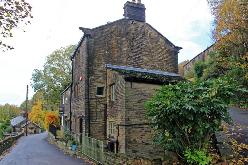
SE 10 NW UNDER BANK OLD ROAD
4/361 (Underbank)
No 57
II
Dwelling part of row. Early-mid C19. Hammer dressed stone. Stone slate roof. Coped
gable and kneeler to south. One ashlar stack. West elevation; one 3-light stone
mullioned window to each floor. Ground floor entrance to right.
Listing NGR: SE1466507464
External links are from the relevant listing authority and, where applicable, Wikidata. Wikidata IDs may be related buildings as well as this specific building. If you want to add or update a link, you will need to do so by editing the Wikidata entry.


Other nearby listed buildings
