Approximate Location Map
Large Map »
Latitude: 53.5628 / 53°33'46"N
Longitude: -1.751 / 1°45'3"W
OS Eastings: 416590
OS Northings: 407385
OS Grid: SE165073
Mapcode National: GBR JW67.QK
Mapcode Global: WHCBG.2QG1
Plus Code: 9C5WH67X+4J
Entry Name: Ward Boundary Stone South of Junction with South View
Listing Date: 4 August 1983
Grade: II
Source: Historic England
Source ID: 1134816
English Heritage Legacy ID: 340514
ID on this website: 101134816
Location: Jackson Bridge, Kirklees, West Yorkshire, HD9
County: Kirklees
Civil Parish: Holme Valley
Built-Up Area: Scholes
Traditional County: Yorkshire
Lieutenancy Area (Ceremonial County): West Yorkshire
Church of England Parish: New Mill Christ Church
Church of England Diocese: Leeds
Tagged with: Architectural structure
SE 10 NE SHEFFIELD ROAD
5/287 (Jackson bridge)
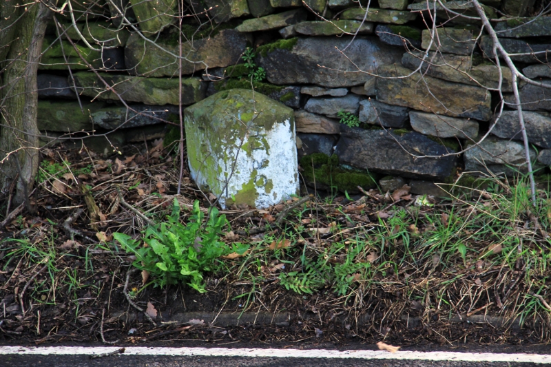
Ward Boundary Stone
50 yards south of
Junction with
South View
II
Ward boundary stone. Mid-late C19. Triangular stone post inscribed:
FULSTON
HEPWORTH
Listing NGR: SE1659007385
External links are from the relevant listing authority and, where applicable, Wikidata. Wikidata IDs may be related buildings as well as this specific building. If you want to add or update a link, you will need to do so by editing the Wikidata entry.


Other nearby listed buildings
